
Perhaps
nothing is more embedded in the psyche of Canada than its national railroads
which were not only the prime movers behind the creation of the country in 1867
but continue to this day to be the principal means of transporting all of its goods.
It may be quicker to fly across the country but there’s no better way to enjoy
the scenery and appreciate the spectacular views of the ever changing landscape
than by sitting in the dome car of the Via Rail train. It’s also the perfect
opportunity to slow down the pace of our overly hectic lives and take in the
nearly forgotten pleasures of a proper meal service and personalized
attendants.


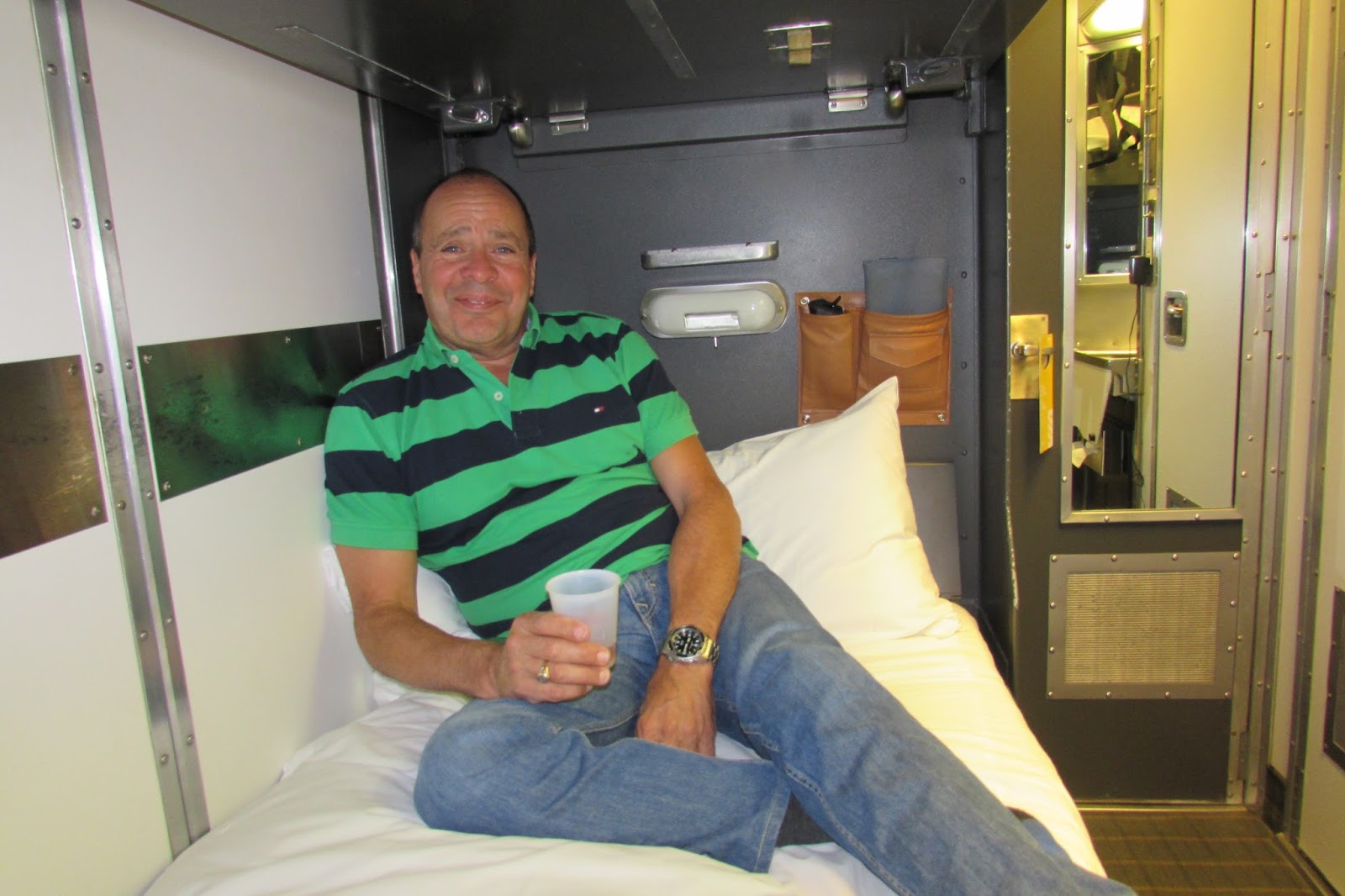
Boarding the
train in Vancouver we were quickly settled into our private room with its own
bathroom and the beds all made up with clean fresh bedding before joining the
other passengers for a champagne send off party. After travelling around the
world it was nice to be in our own country for a change where everyone spoke
the same language and the exchange rate was good. The train was filled with
like minded folks from Europe, Asia, and the U.S. and we looked forward to making
the acquaintance of our closest neighbours.

Along the
familiar Fraser Valley we went, oblivious to any traffic, and then up the
Fraser Canyon itself as we followed the Fraser River and the original gold rush
route of the 1850’s past Hells Gate, and its famous salmon ladders, through a
few of the tunnels blasted out of the mountain in the 1880’s and still in use
today before arriving in Kamloops where the train route now follows the
Thompson River. The Thompson is actually a tributary of the Fraser but there
couldn’t be a greater contrast between the blue/green waters of the Thompson
and the muddy, silt laden waters of the Fraser.


The CN
railway line and the Yellowhead Hwy both follow the Thompson River all the way
to Mount Robson, the highest point in the Canadian Rockies and Yellowhead
Pass, the border between Alberta and British Columbia. Named after Pierre Bostonais, an
Iroquois-Metis trapper hired by the Hudson’s Bay Company to find a way through
B.C. and whose nickname was “Yellowhead” because of his blond hair, the route
was discovered in 1820 and originally proposed for the Canadian Pacific
Railroad. The CPR rejected it in the 1880’s in favour of a different more
southerly route through the Rockies and it wasn’t until 1910 that the CN
decided to use it for their main line route into B.C.


There are two
principal national parks in the Canadian Rockies, Banff and Jasper, with Jasper
National Park being the largest though the town of Jasper is a smaller
commercial centre than Banff. Both are go-to destinations for outdoor
enthusiasts and for anyone wanting to gaze in awe at the mountain peaks on full
display. As the train continued on to Edmonton we also kept our eyes open for
any bears and elk wanting to get their picture taken.


Woke up in the
early morning somewhere in Saskatchewan, a Cree word meaning “swift flowing
river”, and also the name of the 7th largest river in Canada that flows 1,900 km eastward from the
Bow glacier in the Alberta Rockies all the way to Lake Winnipeg in Manitoba. The prairies never looked prettier with
all the colours of the crops in various stages of harvest mixed in with trees
and lakes dotting the countryside and flocks of migrating ducks and geese
passing overhead. It wasn’t a flat, featureless
landscape by any means and we kept ourselves and our fellow passengers amused by
searching for and trying to photograph the no longer ubiquitous red barns and
grain elevators of the square mile farms that once dominated the prairies.


Rarer still
were sightings of buffalo, or more correctly the American bison, that once
roamed throughout most of North America from Alaska to Mexico and from the
Rockies to the Atlantic. Originally numbering over 60 million there were only
500 or so of these magnificent beasts left by 1900 because of the commercial
slaughtering that took place in the 1800’s. Thanks to the efforts of a handful
of ranchers determined to save the animal from extinction the remainder were
gathered together and there are now over 500,000 on private and government
protected land of which 200,000 are in Canada.


After two
days we arrived in Winnipeg, which means “muddy water” in Cree, an apt word
considering it's located at the confluence of the Red and Assiniboine Rivers
in an area now known as “The Forks”. In spite of its
reputation for extreme cold and mosquitoes we encountered neither and, with the
waters below the flood level, we enjoyed a lovely walk along the river banks
and over the Esplanade Riel (a magnificent pedestrian only bridge) into St. Boniface where
Louis Riel is buried.


Originally
vilified in the Canadian history books, as a traitor for fomenting the
North-West rebellion in support of Metis rights, and hanged for treason, he is
now recognized as the founder of Manitoba and a hero of the native rights
movement. As with all First Nations
people, including the Inuit, there is a long history of Canadian injustice and
the Metis, who are the descendents of the intermarrying between French Canadian
trappers and First Nations women, are still working through the settlement
process.


By far the
most intriguing building in Winnipeg is the newly opened Canadian Museum of
Human Rights. An architectural marvel that rises 7 levels from a Great Hall
through a series of spaces and illuminated ramps made from Spanish alabaster to
the Tower of Hope with its spectacular view of downtown Winnipeg. Here the heartbreaking
and shameful history of Canada’s mistreatment of its First Nations people, the internment
of Japanese Canadians and others, the Chinese head tax, the Komagata Maru
incident with the Sikhs, and other disgraceful acts are on full display
alongside atrocities such as the Holocaust. But there is also attention paid to
other contemporary human rights issues around the world that need to be
addressed and examples of the progress slowly being made in spite of all the
ignorance.


Thanks to
its unique river location, as well as being at the longitudinal centre of North
America, Winnipeg has always been an important gateway; first as a canoe
crossroads for First Nations people, later as one of the principal fur trading
posts (Fort Garry) of the Hudson’s Bay Company (after it merged with the North
West Company) and then as a hub for both the CPR and CN railways. By 1911 it
was the 3rd largest city in Canada but since then it has slipped to
number 8 thanks to the Panama Canal and the rise of Vancouver’s importance in
international trade. The “Forks” which was once a massive
railway yard, has since been redeveloped into a vibrant tourist attraction
filled with shops, restaurants, outdoor recreational areas, theatres, and
unique public art.


Besides the
intersection of Portage & Main, another popular tourist attraction is the “Journey
to Churchill” exhibit in the Assiniboine Zoo. Here snowy owls, Arctic
foxes, muskoxen, caribou and wolves are on display as well as polar bears and
seals which can be viewed through underwater viewing tunnels as they swim below
the surface of the water. Costing over
$90 million to build, and using orphan polar bears that otherwise would have
been euthanized, it’s an amazing interactive experience and a fabulous teaser
for anyone wanting to go to Churchill to see the real thing.


After three
days in Winnipeg, including a side trip to see Lake Winnipeg, we got back on
the train for the journey to Toronto which took us through the Ontario portion
of the Canadian Shield. A large swath of exposed Precambrian igneous rock
covered by a thin layer of soil, this rock is as old as the planet itself, and
stretches north from the Great Lakes to the Arctic Ocean and covers most of
Ontario & Quebec. It’s also covered
with countless lakes, with an estimated 110,000 in Manitoba, 250,000 in
Ontario, and 500,000 in Quebec.


Granted
these lakes are mostly quite small but, as we rode along, we could see there
was a beaver dam in nearly every single one. It made for another photo contest
amongst the train passengers and a very graphic appreciation of the role the
beaver played in the development of Canada. It was the fur trade that first
opened up the country to European explorers and settlers and brought them into
contact with First Nations people. Nearly hunted to extinction, the beavers
were eventually saved by the changes in fashion and have since completely
recovered.


One
advantage of train travel over air travel, besides avoiding the security
screening process and all the wasted early check in time, is that you are
always arriving and departing from downtown instead of some distant airport.
Pulling into the Toronto station after two days we were immediately surrounded
by all the high rise office headquarters of corporate Canada. Within minutes we
were out and about mingling with the office workers and other tourists crowding
the sidewalks and bustling in and out of all the buildings.


As Canada’s
largest city, and the 4th largest in North America after Mexico
City, New York and Los Angeles, it’s the country’s centre of arts and commerce
with the CN Tower, the western hemisphere’s tallest free standing structure, the
city’s most recognizable icon. Besides
being the home of the Hockey Hall of Fame, it’s also the only Canadian city
with a major league baseball team. A night at Rogers Centre, formerly the
Skydome, to watch the Blue Jays in their run up to the playoffs was a special
treat.


The word
Toronto in Iroquois means “place where trees stand in water” something that
hasn’t existed for quite some time. The downtown architecture may be dominated
by the financial towers of the banks and telecom companies but the entire city
is filled with high rises, with over 1,800 buildings higher than 100 feet. The
condo boom is even crazier than Vancouver’s but the redeveloped Distillery
District and St. Lawrence Market along the waterfront is a particular delight.
Pedestrian friendly and filled with shops, restaurants, condos and of course
micro-breweries, it was a favorite destination.


In old Toronto there are lots of colourful neighbourhoods catering to various ethnic groups, students, and the LGBT community and featuring old style homes and Edwardian buildings. In the middle of old Toronto are both the Royal Ontario Museum and the Art Gallery of Ontario, and you couldn’t ask for anything more cosmopolitan than what they were offering. The ROM with its radically redesigned entrance was featuring a Chihuly glass exhibit and the AGO was showcasing the paintings of Lawren Harris, one of the Group of 7 artists whose paintings redefined the images of the Canadian north.


A side trip
to the Niagara peninsula introduced us to the largest wine growing area in
Canada as well as the pretty tourist town of Niagara-On-The-Lake which hosts
the annual Shaw Theatre Festival. But
the main attraction is the famous Niagara Falls, located on the Niagara River,
which drains Lake Erie into Lake Ontario and forms the border between the U.S.
and Canada. While the Victoria (108m) and Iguazu Falls (82m) are higher, the Niagara Falls (51m) have a
much higher flow rate; 2,400 cubic metres/second compared to 1,088 and 1,746
respectively. That’s a lot of water and we certainly got a taste of it going
through the Canadian Horseshoe Falls.


Back on the
train after three days in Toronto, this time following the shoreline of Lake
Ontario to Kingston and then turning north up through the farmlands en route to
Ottawa the nation’s capital. In
Algonquin, Ottawa means “to trade” and historically this area was another
important canoe crossroads for First Nations people where the Ottawa, Gatineau,
and Rideau Rivers all came together. Surrounded by forest, Ottawa was a
prosperous lumber town and in the 1850’s had some of the largest sawmills in
the world.


Ottawa
wasn’t always the capital but, after 17 years of alternating and bickering
between Kingston, Toronto, Montreal, and Quebec City, the government of Canada
asked Queen Victoria to pick a permanent capital city for Canada. Located on
the border of Quebec and Ontario, and halfway between the English and French
settlements, Ottawa seemed the perfect compromise so, on New Year’s Eve 1857, she
made it her choice. Work started almost immediately to build the Parliament
buildings, the largest North American construction project ever attempted, and
by 1866 the Gothic Revival style buildings were finished.


Ottawa was originally
named Bytown, after Colonel John By, who was in charge of the Rideau Canal
project to connect Kingston with the Ottawa River. This was a military
initiative to provide an alternate supply route to Kingston from Montreal that
would bypass the stretch of the St. Lawrence River bordering New York State in
case there was a repeat of the 1812 invasion by the Americans. Over 200 km in length and incorporating two
rivers, 16 lakes and 47 locks, the Rideau Canal was completed in 1832. It has
been recognized by UNESCO as a work of genius and is still used to this day by
boats up to 100 feet in length and 25 feet in width. In the winter part of it
becomes the world’s largest outdoor skating rink.


Being the
nation’s capital Ottawa has the most incredible collection of museums and
galleries. Of particular significance are the National Gallery of Canada, the
Canadian War Museum, the Canadian Museum of Nature, the Canadian Aviation and
Space Museum, and the Canadian Museum of History. Here we walked through the
breathtaking Grand Hall with its Pacific Coast totem pole exhibit, the largest
indoor collection in the world, and the First People’s Hall outlining the
Aboriginal history from 500 years ago to present time.


From the founding of Tadoussac in 1600 there were First Nations conflicts and 100 years of “Beaver Wars” that followed between the French backed Algonquin-Huron alliance against the Dutch & British supported Iroquois confederacy. The Great Peace of Montreal in 1701 ended the conflict but then another 100 years of colonial warfare on Canadian soil started between French and British troops, until France withdrew from North America after signing the Treaty of Paris in 1763. The American Revolution then followed in 1776 – 1783 with France supporting the Americans colonies against the British as they invaded Montreal and attacked Nova Scotia. The 19th century brought the War of 1812 when once again the Americans tried unsuccessfully to invade Canada. To contain any further ideas of American expansionism after their Civil War ended in 1865, the British colonies of Quebec, Ontario, New Brunswick and Nova Scotia were federally united in 1867 as the Dominion of Canada. In 1868 the Militia Act was passed to create a volunteer defence force and in 1873 the North-West Mounted Police was created. In 1885 the two forces joined together to put down the Louis Riel led North-West Rebellion, on what would become, the last battle fought in Canada.

In spite of being a Dominion, Canada did not have full legislative autonomy until 1931, with the passing of the Statute of Westminster. (It wasn’t until 1982 under Prime Minister Trudeau the Elder that the Constitution, along with the Charter of Rights was finally patriated to Canada) While Canada voluntarily supplied troops for the 1899 – 1902 Boer War in South Africa, it was automatically drawn into World War 1 (1914 – 1918) when Britain declared war on Germany. In spite of having a population of only 8 million a total of 620,000 men and women served in the Canadian forces and of these 60,000 were killed and 154,000 were wounded. By the time the 2nd World War rolled around (1939 – 1945) Canada decided on its own to declare war on Germany and, out of a population of 11.5 million, over 1.1 million served in the armed forces. While the losses were still significant, with 45,000 dead and 55,000 wounded, it wasn’t anything like the trench warfare slaughter of the First World War.


Less than 2 hours by train takes you from Ottawa to Montreal, the historic commercial capital of Canada, the largest city in Quebec, and the 2nd largest French speaking city in the world after Paris. Named after “Mont Royal” the name given to the hill in the centre of the city that also forms its largest park, the city is referred to as the cultural capital of Canada with its bilingual population and hundreds of summer festivals including Just For Laughs, the world’s largest comedy festival and the Montreal International Jazz Festival, the world’s largest jazz festival.

It's also home to McGill University, the number 1 university in Canada, and of course the Montreal Canadians, the most winning hockey team in the NHL. Filled with funky, tree lined neighbourhoods all offering great places to eat and drink, the most reasonable rents in Canada, and featuring colourful wall murals everywhere you turn, the city has a look and feel that is that is uniquely very human in scale. All of which makes it easy to sit back and enjoy.


While the French explorer Samuel de Champlain first tried to establish a fur trading post at Montreal in 1611, it wasn’t until the British took control in 1760 and the North West Company was formed in 1779 that the golden age of fur trading really began, as well as an intense rivalry with the Hudson Bay Company who they eventually merged with. More and more Scottish and English immigrants continued to settle in Montreal and establish businesses including Molson Brewing in 1810, the Bank of Montreal in 1817, the CPR in 1880, the CN in 1919 and the Royal Bank in 1928. Up until the 1930’s Montreal was the most important economic centre in Canada with virtually all of the country’s financial institutions and transportation companies headquartered here.


Many of these historic buildings are still on display as you wander through St. James Street in Vieux Montreal along with famous churches such as Notre-Dame Basilica and the Notre-Dame-de-Bon-Secours Chapel or “Sailor’s Church”. Saint Joseph’s Oratory is the largest church in Canada with the second largest dome in the world after Saint Peter’s Basilica in Rome. A perfect city for walking and exploring, particularly through the Latin Quarter, along St. Catherine, or in Vieux Montreal, it also has a fabulous Metro to whisk you anywhere else you need to go. Old and new architecture, cathedrals, shops, bars, and fabulous restaurants are everywhere you turn and all with a laid back vibe that takes away the pressure even though this is still Canada’s 2nd largest city.


On the 4 hour train journey to Quebec City evidence of the old Seigneurial system of land allotments was on full display with farms laid out in long, narrow strips along the St. Lawrence River. The system made for easy access to transportation and kept habitants close to other families with each farm only a hundred yards or so from one another. Contrast this with farmers in the prairies that were laid out in the checkerboard style of the township system that put each farm a mile apart from the other.


After checking into our room inside the walls of Vieux Quebec (a World Heritage Site) we went for a late afternoon stroll along the promenade of the Citadel enjoying the view of the St. Lawrence and realizing what a perfect location it was for a military establishment. Founded in 1608 by Samuel de Champlain, Quebec (the Algonquin word for “where the river narrows”) is one of the oldest cities in North America and the ramparts surrounding Old Quebec are the only fortified city walls remaining in the U.S. and Canada.


Quebec City was the capital of New France and headquarters of many raids against New England and the site of three battles between the British & French until France finally ceded New France to Britain in 1763 as part of the Treaty of Paris. In exchange France got to keep the rich sugar colony of Guadeloupe, fishing rights off of Newfoundland and the St. Lawrence fishing ports of St Pierre & Miquelon.


The old town is filled with lively restaurants, souvenir shops, and military history including of course the Plains of Abraham where, after a 3 month siege, the British under Wolfe defeated the French under Montcalm in a 15 minute battle that ended up killing both generals. It also contains the magnificent Chateau Frontenac, the principal architectural attraction of the city and the most photographed hotel in the world. Outside the walls of Vieux Quebec are the provincial legislative buildings, a vibrant commercial centre and the picturesque train station, Gare du Palais, which is modelled after the Chateau Frontenac.


Leaving Quebec City we journeyed through the colourful forests of the Jacques Cartier National Park en route to Saguenay, a city formed by the merger of Chicoutimi, Jonquiere, and La Baie and located on the Saguenay River/Fjord. Carefully heeding the moose warnings while taking in the autumn foliage it was hard to believe an area with so much scenery was also the centre of both a large aluminium plant and pulp & paper industry.


From Saguenay to Tadoussac, where the fjord meets the Saint Lawrence River, is a National Marine Conservation Area, one of only 4 that exist in Canada, and the road offers magnificent views of the waterway and surrounding cliffs. Whales of many species including; minke, fin, blue, humpback, and a resident colony of belugas are drawn here by the rich food supply created by the mixing of fresh and salt water. In addition there are harbour porpoises, the surprisingly large grey seals and many species of migrating sea birds.


Based out of Tadoussac, the charming and colourful town established in 1600 as the very first French trading post in New France and the oldest continuously inhabited settlement in Canada, whale watching tours depart every morning and afternoon and there is also a large marine mammal interpretation centre that provides a perfect complement to any tour.


Another picturesque highway follows the north side of the shoreline of the St. Lawrence from Tadoussac to Quebec City passing through pretty villages and magnificent hillsides all while taking in the sparkling water of this signature river. Ever since it was first discovered by Jacques Cartier in 1535 it has been critical to the exploration and settlement of Canada. Originally only navigable to Montreal because of the Lachine Rapids, an ongoing series of locks and canals built over the years, and culminating with the completion of the St. Lawrence Seaway in 1959, have since made it possible for ocean going ships to go all the way to ports in Lake Superior.


Leaving Quebec City at night for the final leg of our journey we follow the south shore of the St. Lawrence, pass through the forests of New Brunswick, and come out in the farmland of Nova Scotia before arriving in Halifax 20 hours later. We have now traversed the entire country by train and it’s a little sad saying goodbye to the Via Rail folks who have done such a great job of keeping us well fed and watered while providing us with such a scenic passage. As the train readies itself for the return journey we set off to explore another great Canadian city and one that is rated as one of the nicest places to live anywhere in the world.


First stop in Halifax was Citadel Hill, a fortified summit overlooking the Halifax Harbour and headquarters of the Canadian Atlantic Fleet that was first started in 1749 when the town was founded and finally completed in 1856. While it was never attacked, the Citadel was a key component of the British forces in their frequent battles with the French, a strategic defense in the event of war with the Americans, and a logistical base for the Expulsion of the Acadians from 1755 – 1764. It’s also the location of the Town Clock which has kept time for the city since 1803.


Located on the lively and colourful downtown waterfront, and bearing testament to its rich maritime history, is the Maritime Museum of the Atlantic, the oldest and largest maritime museum in Canada. On display inside are a large collection of ship models while outside visitors can explore historic vessels on the dock and other small craft. Perhaps the most moving exhibit is the Halifax Explosion where, in December 6th 1917, the SS Mont Blanc, a French cargo ship carrying munitions, collided with the Belgian relief vessel the SS Imoin. The resulting explosion was the largest artificial explosion before the development of nuclear weapons, and it killed over 2,000 people, wounded another 9,000 and destroyed every building within a 2.6 kilometre radius.


Fortunately the city was able to rebuild itself and today the urban core has a vibrant cultural scene with public sculptures, art galleries, theatres, festivals, and, thanks to the numerous post secondary institutions, a large student population that keeps the bars and restaurants hopping, especially along Argyle Street. All in all a wonderfully compact, safe, and very clean city to explore.


But the real Nova Scotia is found along its coast and the most famous spot of all of course is less than 50 km away at Peggy’s Cove with its lighthouse on Peggy’s Point. A typical fishing village nestled into one of the countless coves along the eastern and southern shoreline that provide protection from the Atlantic Ocean, and where lobster fishing is still the mainstay of the economy. Following the coastal road as opposed to the interior freeway means it can take hours to only journey a short distance but the scenery is over the top.


The clear, blue ocean water meeting with powdery white sandy beaches seems to meander along forever and in every cove are modest little houses perfectly positioned to take in the beautiful view. Arriving at the colourful port town of Lunenburg, another UNESCO and Canadian historic site, we check out the Bluenose 2 and other attractions before tucking into some fresh lobster, fries, and local craft beer at a sunny, outdoor patio.


After all, when you talk about maritime traditions in Nova Scotia, it’s all about the seafood and beer. It’s also the end of the road for us and what a perfect finale.


If anything the trip has not only shown us how large the country really is but also how much more we still have to explore. Already we are planning a road trip to the Yukon and the Northwest Territories, another rail journey from Winnipeg to Churchill to see the belugas and polar bears, a return to Ottawa to see more museums, a boat cruise in Kingston to take in the Thousand Islands, attending the Jazz Festival in Montreal, and spending more time exploring Nova Scotia including the Cabot Trail in Cape Breton, whale watching in the Bay of Fundy, and checking out more of the beautiful coastline. It was the railway that stitched together this country from coast to coast and what an educational journey it has been learning about our history as we rode the rails from one end to the other.

No comments:
Post a Comment