 |
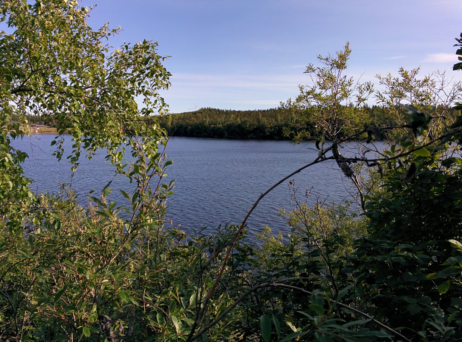
Inukshuk at Top of the World Highway Rest Area
|
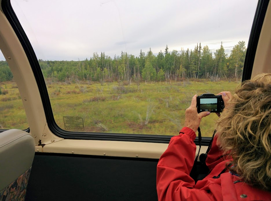
Wanting to continue our exploration of the North country, but also skip the first 2,400 km of driving to Whitehorse, we took off from Vancouver with the delightful Air North (the only North American airline still operating with free baggage and free full meal service, not to mention super friendly staff) flying over the beautiful Coast Mountains, and the horrific forest fires engulfing the Province of B.C. and landed in the Yukon capital in less than 1.5 hours.
 |
| Elk in a death lock at Whitehorse Airport baggage carousel |
The two elk in a death lock on the baggage carousel were the first example of the magnificent displays of taxidermy we would encounter on our journey and, of course, perfectly symbolized the eternal life and death struggle for survival that permeates everything past, present, and future in the North. Whitehorse itself is a very pretty town with an outdoor focus, nestled within the banks of the Yukon River, and has more than 700 km of trails connecting neighbourhoods with mountains, lakes and rivers. The first one we encountered was the 5 km Millennium Nature Trail, a lovely stroll along both sides of the river with a nice pedestrian bridge and interpretive forest path that in turn connected with the delightful waterfront walkway that goes alongside the railway tracks through town.
 |
| Aerial view of Whitehorse from the south end showing the S.S. Klondike in the foreground |
 |
| Yukon River in Whitehorse |

While Whitehorse, with an approximate population of 25,000 is now the capital city of the Yukon it didn't start out that way. As a result of the famous Klondike Gold Rush in 1896 - 1899 the original capital was Dawson City but, it was Whitehorse (so named because of the foaming White Horse Rapids of the Yukon River near Miles Canyon just south of where the city is located) that provided a safe and practical entry point to the river. Until the river was dammed in 1958 these rapids were a severe navigational obstacle to transportation but now they are part of the dam's reservoir and the dam provides hydro electric power to the city of Whitehorse which is situated downstream.
 |
| Whitehorse Rapids Dam |
 |
| Yukon River |
The Yukon River (the 3rd longest river in North America after the Mississippi & Mackenzie) starts in the glacier fed watershed of the Atlin and Tagish Lakes in B.C. and proceeds in a northwestern direction for 2,000 miles through the Yukon and Alaska until it empties into the Bering Sea. The Yukon River was the principal means of transportation in the area during the gold rush and, until the 1950's when the Klondike Highway was completed, up to 300 flat bottomed paddle wheelers like the SS Klondike provided transportation and shipping services for communities along the river.


While Whitehorse may have been the entry point to the Yukon River, where a prospector could then find a boat of some sort that would take them to Dawson City, getting to Whitehorse was not for the faint of heart. The shortest route was hiking up the either the infamous Chilkoot Pass Trail from Dyea, or the White Pass Trail from the rival port of Skagway, through the Coast Mountains up to Bennett Lake where a raft could be purchased or built to float down the Yukon River to the White Horse Rapids. The Chilkoot Pass was 3,700 feet up and the White Pass was 2,900 feet up and both trails were roughly 30 miles in length.


While the hike itself might not have been so bad for a relatively experienced and properly equipped person who could expect accommodations and provisions upon arrival this was not the case at the height of gold rush fever. The Canadian government decreed that each person coming into the country had to have 2,000 lbs. of food, clothing, and equipment to last them a year and transporting this to the border checkpoint meant 40 - 50 return trips in horrific conditions. In the winter of 1898 22,000 men, determined to find fame and fortune in the Klondike, were checked through the Chilkoot Pass by the R.C.M.P.

It was obvious a more practical solution was required and that summer construction started on the narrow gauge White Pass & Yukon Route Railway from Skagway to Whitehorse. It was completed by July 29, 1900 just as the gold rush ended but, it has been in operation ever since providing freight and passenger transportation services and is now an important component of the cruise ship tourist industry.

Being the capital city of a Territory means having some great museums and other attractions and, after getting organized at the local Visitor Information Centre, one of the first to explore was the MacBride Museum with it's incredible collection of local mammals and birds. Located within the original government telegraph office building, it also serves as an archive where the history of the Yukon is preserved and put on display, and a meeting place for educators and students. There are galleries featuring the art of Ted Harrison, the 14 First Nations of the Yukon and, of course, all the transformative events that marked the development of the Yukon.
 |
| McBride Museum |
They also own and operate the historic waterfront trolley that goes from one end of town to the other starting at the S.S. Klondike National Historical Site and then running parallel to the Yukon River and the City's main streets with a stop at the Museum itself and finishing up at Spook Street Station.
There is also the Kwanlin Dun Cultural Centre that represents the return of this particular First Nation to its traditional home along the banks of the Yukon River. Welcoming others to share in their history and culture there are all sorts of displays and presentations being offered but, while the Kwanlin Dun people have put a positive spin on things, one can't help but feel saddened about how they were treated in the past and so thoughtlessly moved aside in the rush to commercialize things.

There was, however, another group that were living in the area long before any humans when the Yukon, Alaska, and eastern Siberia formed a lost sub-continent called Beringia. During the last glacial period (between 15,000 and 125,000 years ago) this area was untouched by the glaciers covering the rest of Canada and the sea level dropped by up to 125 metres which enabled a land bridge and grassy tundra to develop. Living on this grassy tundra were giant mammals such as woolly mammoths, scimitar cats, steppe bison, giant short-faced bears, Beringian lions, Yukon horse, grey wolves, and Saiga antelope.


Early First People also took advantage of this land bridge 15,000 years ago to migrate from Asia to North America and within a few hundred years had made it all the way to the tip of South America. Then,10,000 years ago as the glaciers started to melt, water covered the land bridge and everything disappeared under what is now the Bering Sea. It would have been lost forever if it wasn't for all the mining activity in the north where the remains of these animals and people have since been discovered and put on display at the outstanding Beringia Interpretive Centre. The woolly mammoth for example is the largest one ever recovered in North America.


Checking out all these museums and other attractions, such as the nearby transportation museum, or doing a walking tour of all the murals in town, is thirsty work but fortunately Whitehorse is also the headquarters for the famous Yukon Brewing Company, and iconic bars and restaurants like the Dirty Northern & Miner's Daughter in the Capital Hotel, and of course the Klondike Rib & Salmon which all offer great food and libations.
Leaving Whitehorse, birthplace of Pierre Berton, Canada's foremost writer of Canadian history and non-fiction including, of course, Klondike The Last Great Gold Rush 1896-1899, it was off to Dawson City where the action all began.
 |
| Route of the S.S. Klondike |
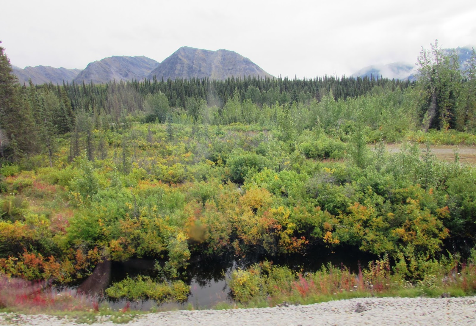
Before the Klondike Highway was completed in 1950 there was really only one way to reach Dawson City and that was of course by travelling down the Yukon River. The Yukon River is fed by too many tributaries to mention and its entire watershed/drainage area is over 325,000 square miles which is roughly 25% larger than Texas or Alberta. As the highway follows the river quietly winding its way through the valley between the mountain ranges, it offers up an incredibly beautiful view of the surrounding countryside of the Tintina Trench.
 |
| View of the Tintina Trench |
Extending for hundreds of miles across all of the Yukon in a nearly straight line from Alaska to British Columbia, the Tintina Trench is a fault line that, over the past 65 million years, has shifted the bedrock over 450 km. Approximately 8 million years ago the earth's crust separated along the fault line creating a wide valley or trench.
Just outside of Whitehorse we passed the pretty Lake Laberge, made famous by Robert Service in his poem "The Cremation of Sam McGee".
There are strange things done in the midnight sun
By the men who moil for gold;
The Arctic trails have their secret tales
That would make your blood run cold.
The Northern Lights have seen queer sights.
But the queerest they ever did see
Was that night on the marge of Lake Lebarge
I cremated Sam McGee.
 |
| Lake Lebarge |
 |
| Yukon River |
 |
| Yukon River |
 |
| Yukon River |

Along the way we stopped for coffee & cinnamon buns at the Braeburn Lodge, an official checkpoint on the famous 1,000 mile Yukon Quest annual dog sled race from Fairbanks to Whitehorse (which is arguably the toughest dog sled race of the North in spite of the equally famous Iditarod race from Anchorage to Nome). Established in 1984 it follows the route of the Klondike Gold Rush.
 |
| Yukon Quest Route |
We also stopped in at the historic Montague Roadhouse, which was no longer offering accommodation, meals, or services for my horse.


 |
| 5 Finger Rapids |
 |
| 5 Finger Rapids |
Shortly past 5 Finger Rapids we temporarily said goodbye to the Yukon River as we parted ways for the final stretch into Dawson City after watching some canoeists navigate the Pelly Crossing.
As we pulled into Dawson City the first thing that greeted us were the enormous piles of rock tailings everywhere that were left over from the gold dredges used in various placer mining operations. Placer mining, as opposed to hard rock mining, is the mining of stream bed deposits for gold and it involves processing loose rock and sand through sluices and screens to separate the heavier gold from the other lighter materials. The simplest method is panning, which is how gold is first discovered but, in order to process river gravel in any quantity, larger, more efficient methods such as dredges are used.
|
|
Aerial view of modern day Dawson City nestled on the Yukon River
|

Dredge No. 4 was a self propelled gravel gobbling bucket line sluice monster that mined gold on the Yukon River from 1913-1959 and is now a historic site. With its 72 buckets excavating gravel at a rate of 22 buckets per minute it could process 18,000 cubic yards of material a day. While there were many other dredges of similar design in operation, at 8 stories in height, Dredge No. 4 was the largest wooden-hulled dredge ever built in North America. These monsters were brought in after the initial gold rush frenzy was over and continued in operation until the 1950's squeezing gold out of the river bed and surrounding hills.

Before any dredging can begin the gold has to first be discovered, and it was on August 16th,1896 that George Carmack, Skookum Jim and Dawson Charlie discovered gold in huge quantities while panning the waters of Bonanza Creek which flows into the Klondike River that, in turn, joins the Yukon River at what is now Dawson City. Rumours of gold in the Yukon had been circulating for more than 50 years and there were plenty of other prospectors in the area so, when the first claims were registered, word got out quickly and the entire Bonanza Creek and the nearby Eldorado Creek were soon completely staked. But, it wasn't until the following summer, when the millions of dollars of gold finally reached San Francisco, that The Rush began.

In spite of all the good claims being already staked more than 100,000 people rushed to the Klondike between 1896-1899 to try and seek their fortune and of course most failed spectacularly, other than those operating saloons, hardware stores or brothels There were 3 routes to get there and none were easy. In addition to the Skagway/Dyea route, there was the all Canadian route over rivers and mountains or the expensive all water route cutting through the Aleutian Islands and heading up the Yukon River. In the end most people went to work for the owners of the claims as labourers with a small share in the profits or simply ended up going back home. From a population of 500 in 1896, the town of Dawson grew to 30,000 by the summer of 1898. Built of wood and being isolated and unsanitary it suffered from fires, high prices, and epidemics but, despite this, the prospectors spent extravagantly as they gambled and drank in the saloons and partied with any enterprising women who were also in town.
 |
| Aurora Inn |

 |
| Keno Bar at the Westmark |
Arriving in modern day Dawson City we quickly checked into our charming hotel, the Aurora, and then headed off to look for the first saloon we could find which was the Keno at the Westmark where a piano player was busy putting everyone in the Klondike spirit. The town has tried to keep the wild west look and feel of the Gold Rush years, with unpaved streets and wooden boardwalks, while at the same time ensuring the buildings are well maintained and brightly painted, particularly those of historical importance like Bombay Peggy's brothel and the Downtown Hotel where we would spend a considerable amount of time during our stay.
 |
| Bombay Peggy's |
 |
| Downtown Hotel |
 |
| Inside the Downtown Hotel |
The Downtown Hotel is the home of the famous SourToe Cocktail, a disgusting ritual that takes place every evening from 9-11 pm with folks lined up throughout the bar area patiently waiting their turn to drink a shot of whiskey with a blackened old toe floating in it. I was the 82,639th person to perform this feat of bravery and duly received my official certificate of proof from the Sourtoe Captain once the toe had touched my lips.
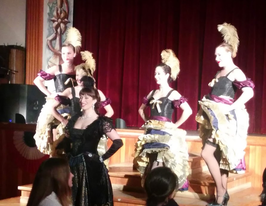
A considerably more pleasant and pleasing experience awaits next door at the equally famous and historic Diamond Tooth Gerties Gambling Hall, Canada's first casino, where customers can do a little gambling, knowing all profits go to charity, take in one of the nightly cancan style floor shows featuring the high kicking Gold Rush Girls, and laugh with the saucy hostess Diamond Tooth Gertie herself.
 |
| Diamond Tooth Gertie's |
Also tried my hand at a little old fashioned gold panning to get a taste of how back breaking it is for any would be prospector to search for the proverbial needle in a haystack. There are still a number of active gold mines on the Klondike using smaller scale dredging operations and, with modern technology & machinery, it's considerably easier nowadays to dig up the permafrost all the way down to the bedrock where most of the gold actually lies, but it still requires a lot of water to process.
 |
| Aerial view of mining operations near Bonanza Creek |
In spite of Dawson City being mostly a tourist town now, with a population of only 1,400, there are plenty of interesting things to see and explore like the Danoja Zho Cultural Centre, the City Museum, all sorts of funky shops, historical buildings, restaurants and, of course, the Visitor Information Centre.
 |
| Dawson City Museum |
Being in Dawson City on the anniversary date of the Klondike gold discovery was especially fortuitous and we decided to go for a Yukon River cruise to celebrate. Stepping onto the Klondike Spirit we were given an overview of the history of the gold rush, learned about the goings on in modern day Dawson, and got to experience being on the river itself which is such an integral part of the Yukon and Alaska.


Leaving Dawson City we were now off to Inuvik, once again in the care of the good folks at Air North. We would have liked to have driven the Dempster Highway but, that would have added another 4 days there and back and, with our final destination being Tuktoyaktuk, on the Arctic Ocean, we still had a lot of ground to cover. Flying over the green vastness of the Porcupine River system (which also flows into the Yukon River and is home to thousands of caribou) and the countless lakes & rivers of the Mackenzie Delta, once again brought into focus the incredible size of the north country, the distances between places, and the beauty of this landscape.
 |
| Porcupine River |
 |
| Mackenzie River Delta |
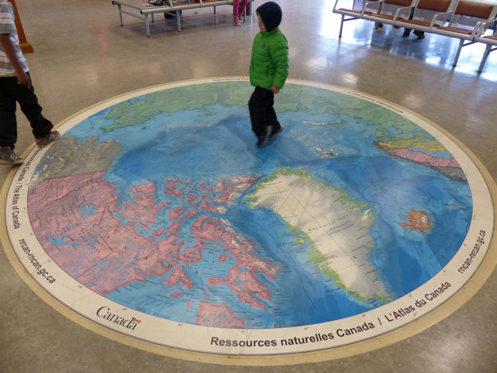
Landing in Inuvik, after having crossed the Arctic Circle, we were of course greeted by a polar bear. We were back in N.W.T. the furthest north we had ever been, and the unique polar floor map in the airport provided an opportunity to stand at the top of the world and view Canada and the North from a new perspective. With global warming a lot of change is coming to this part of the world and it will be interesting to see how everything adjusts.
 |
| Inuvik Airport waiting area |
 |
| Polar floor map at Inuvik airport |
Our first order of business was to pick up our rented vehicle and this is where the adventure began and we could appreciate the local saying #welcome to the north. Things don't always go as planned and you don't always get what you bargained for. The supposed SUV we had reserved turned out to be a rather decrepit old pickup truck but it worked better than it looked and at least we had wheels.
It also gave us a chance to meet up with an affectionate group of beautiful white huskies whom we planned on getting to know even better when we returned next March for some winter activities.
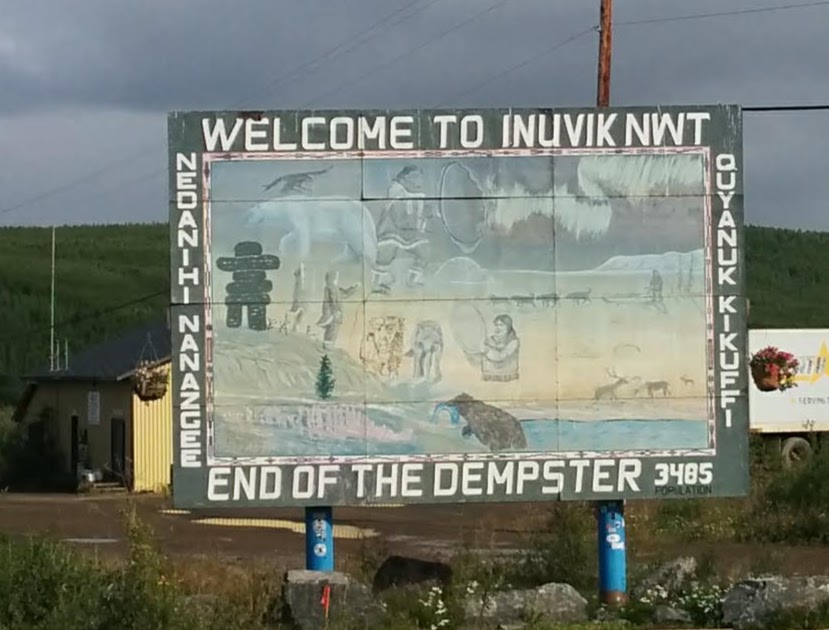
Inuvik is a small administrative town of 3,500 people situated on the Mackenzie River in N.W.T. 200 km. north of the Arctic Circle. Located between the northern boreal forest and the treeless tundra, it has 56 days of 24 hour daylight in the summer and 30 days without sunshine in the winter. The first building you come to as you enter the town is the Western Arctic Visitor Centre which is filled with interesting exhibits and helpful information. The Midnight Sun complex offers an NHL size arena, first class gym, and a fully featured aquatic centre. The other featured attraction of the town is the Igloo church.
 |
| Western Arctic Visitor Centre |
 |
| Unity Within Diversity Sculpture outside the Western Arctic Visitor Centre |
This beautiful 3 ton sculpture, made from glacier spun marble and sitting on a piece of granite, is the work of 5 artists from the N.W.T.. It features 2 polar bears noses touching representing the Eastern & Western Arctic by Paul Malliki, an Inuk from Repulse Bay, the body of an eagle by Dolphus Cadieux, a Dene from Yellowknife, a drummer by Eli Nasogaluak, an Inuvialuit from Tuktoyaktuk, the sea Goddess Sedna, by Bill Nasogaluak, also from Tuktoyaktuk, and a fiddle by Allyson Simmie, a resident of Iqualuit.
 |
| Midnight Sun Complex |
 |
| Igloo Church |
It was also nice to go for an easy hike around Boot Lake Trail, a 3km loop around Boot Lake, that is part of the Trans Canada Trail.
 |
| Boot Lake |
The most curious feature of Inuvik is how they handle their water, sewer and utilities. Because the ground is made of thaw sensitive permafrost things have to be built differently up north. If permafrost is disturbed enough to make it thaw the ground will sink and any structure on top will be damaged. To avoid this buildings and pipelines are often built above ground on a frame so that cool air can pass underneath and prevent any thawing of the permafrost from the heat of the building or pipeline. As a result you can see, what are called Utilidor lines, running throughout the Town carrying water and sewage to all the buildings.
 |
| Above ground water & sewage pipes in Inuvik |
 |
| Utilidor lines in Inuvik |
As satisfying as it was to arrive in Inuvik, we still had the final leg of our journey to complete, and that was driving on the newly constructed road to Tuktoyaktuk. Dreamed about for years, as a way to connect with the potential oil and gas riches of the Beaufort Sea and bring down the ridiculously expensive costs of getting people and supplies to the Arctic Ocean, the road was finally completed in the winter of 2017/2018, but it wasn't easy. The permafrost prevents the construction of all season roads in the north since the ground will simply heave and sink as it thaws, "It's like building on the back of a serpent" was the quote from one contractor. But for this project they came up with some new ideas like swaddling the permafrost with 1.5 metres of gravel to act like a protective blanket that would shield the ice from the sun and heat of the road. They also used special geotextiles, plastic culverts, and only worked in winter when everything was frozen.
 |
| Tuktoyaktuk Highway |
 |
| Tuktoyaktuk Highway |
 |
| Tuktoyaktuk Highway |
The result was a fabulous, beautifully graded highway and on a bright sunny morning we said goodbye to Inuvik and headed off on this new and relatively untravelled road to see what awaited us. Very quickly we left the sparse boreal forest behind as the road meandered in a pleasantly winding fashion through the grassy tundra. Everywhere was green land, blue skies, countless lakes and a roadside decorated with pretty fireweed. Hard to believe this area is usually covered in snow.
Then, as we got closer to the Arctic Ocean, where all the channels of the MacKenzie Delta flow into, we saw our first pingo. A pingo is basically a mound of earth covered ice. They are formed as a result of permafrost pressure in a drained body of water that causes the frozen ground to rise and an ice core to form. They are common throughout countries that border the polar north but Tuktoyaktuk has the highest concentration of pingos in the world with over 1,350 examples.
 |
| Pingos |
 |
| Pingo |
 |
| Pingos in Tuktoyaktuk |
At last we arrived in Tuk, as the locals all say, with the cold wind blowing off the Beaufort Sea reminding us we were at the end of the only highway in Canada that crosses the treeline and the only one that reaches the Arctic Ocean. It also marked the end of the Trans Canada Trail.
 |
| Tuktoyaktuk Land Of The Pingos |
 |
| Arctic Ocean Tuktoyaktuk |
 |
| Canada Trail Marker Tuktoyaktuk |
Having travelled this far I still had one important task to complete, and that was going for a dip in the Arctic Ocean. It would have been cheating to put on my wetsuit so I had to do things "polar bear style" with little more than my thin skin to keep me warm and out I went in the wind over a rock strewn beach to do my duty. Needless to say in 2 degrees Celsius (36 Fahrenheit) I didn't last very long but it was long enough to get my certificate from the local witness.
 |
| Tuktoyaktuk swimming area and lifeguard |
 |
| Nelson entering the Arctic Ocean at Tuktoyaktuk |
 |
| Nelson trying to swim in the Arctic waters of Tuktoyaktuk |
Sampled a little muktuk, the traditional Inuit meal of whale skin & blubber that provides an excellent source of Vitamin C and is the secret to the Inuit being able to survive without fresh fruit or vegetables, something the European explorers never figured out and ended up suffering with scurvy. We also enjoyed a beach side BBQ and picked up some nice souvenirs made by the local carvers.
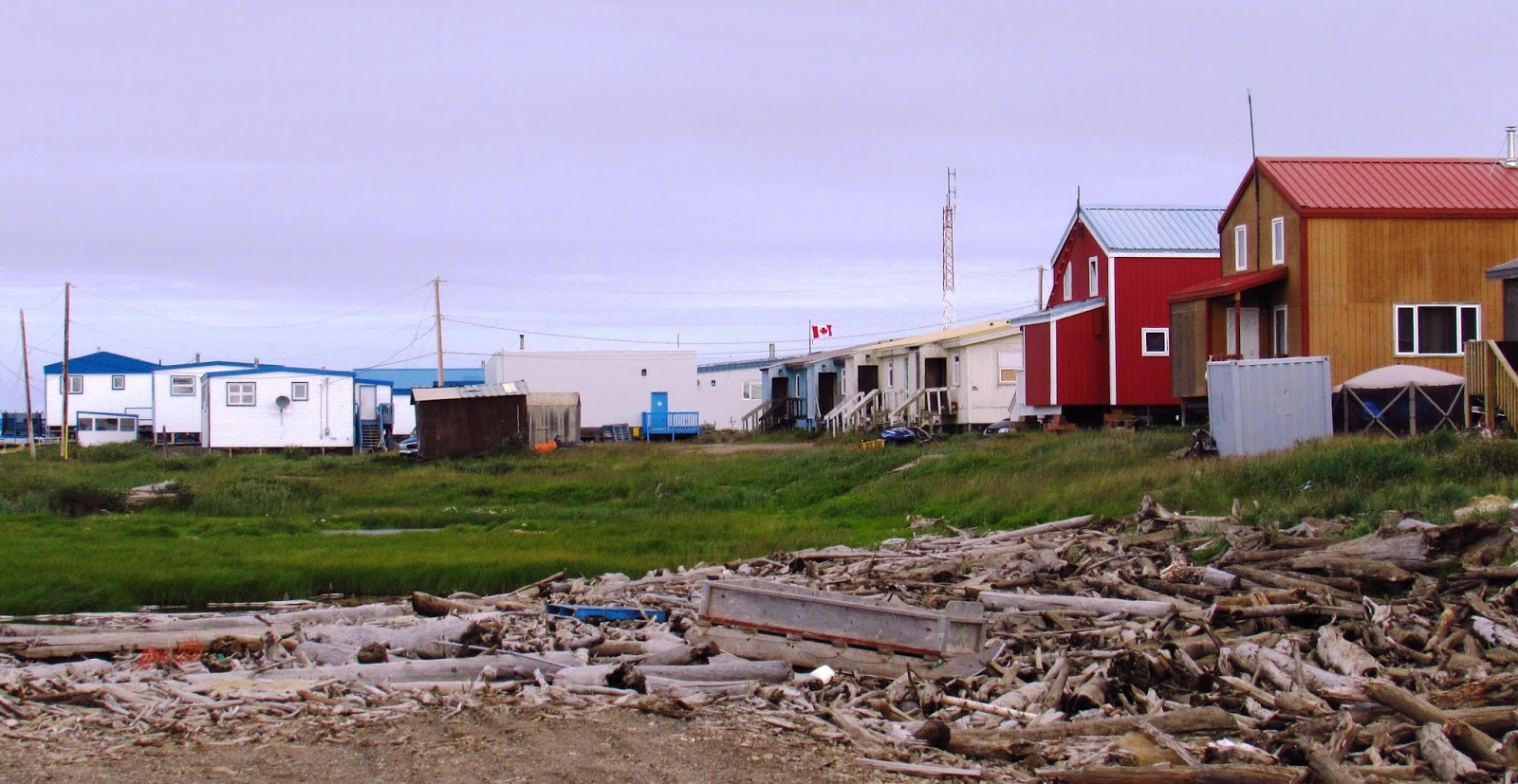
Poor Tuk has seen better days. In the heydays of the 1970's and 80's when all the oil & gas exploration was taking place the town's population swelled to over 3,000 and things were booming but, when the price of oil collapsed, it all shut down and the population has since dwindled to only 1,000. During the Cold War Tuktoyaktuk was established as a Distant Early Warning radar site to detect Russian bombers flying over the North Pole but that ended in 1993 and the buildings are now part of an unattended short range radar North Warning System.
 |
| Old DEW Line installation in Tuktoyaktuk now a NWS site |
But it's hoped the new road will bring tourism and a new life to the town and help it get back on its feet again. For Canada to assert its sovereignty in the North we need to build more roads between the communities that exist, establish deep water ports for ice breakers, cruise ships and freighters that will increasingly be taking advantage of more ice free days in the Arctic, and manage the resources in partnership with the First Nations people who live here. In the meantime the freshly painted, windswept town will just have to persevere as it always has with its hunting, fishing, trapping, and pingos.

 |
| Aerial view of Tuktoyaktuk |
 |
| Big Pingo |
From Tuktoyaktuk it was now time to head south (indeed there was no other option) and so, after flying back to Dawson, we boarded a little micro-bus to Fairbanks and said goodbye to the Klondike. We crossed the Yukon River on the George Black ferry, a free service operating 24/7 (until winter freeze up) that connects the Klondike Highway to the Top of the World Highway.
 |
| George Black Ferry |
The Top of the World Highway, so-named because most of it is built along the crest of the hills, is only open in summer months and, while it was a little hair raising, not to mention windy and cold, it was also very beautiful straddling the ridges and getting to view the Oglivie Mountains.
 |
| Aerial view of Top Of The World Highway |
 |
| Top Of The World Highway |
 |
| Top of the World Highway Rest Area |
 |
| Top of the World Highway Rest Area |
 |
| U.S. Canada Border Crossing at Top of the World Hwy. |
First stop after clearing customs at the most deserted customs station between Canada and the U.S. (and only open in summer) with only 3 inhabitants at either side and nothing much for them to do except stay warm, play poker, and provide a colourful stamp for everyone's passport, we arrived in the bustling metropolis of Chicken, Alaska.
Named Chicken because nobody could properly spell Ptarmigan, the actual chicken sized bird common to the area, the hamlet is a colourful rest area with great food & drink, souvenirs, and photo opportunities with a focus, of course, on everything chicken.
After a long day on the bus travelling through the equally beautiful boreal forest of Alaska, we finally arrived at our destination in Fairbanks in time for dinner and some well deserved libations.
Not surprisingly Fairbanks, with a population of approximately 35,000 is listed as the coldest large city in the U.S. with an average temperature ranging from -8 F (-22 C) in winter but in summer it's quite pleasant averaging 63 F (17 C) and the sun was shining as we went out exploring. First stop was the delightful Visitor Centre located along the bank of the Chena River with its beautiful gardens, interesting public art, and world class exhibits.
 |
| Antler Arch |
 |
| Unknown First Family Sculpture |
By far the most impressive local attraction is Museum of the North located on the grounds of the University of Alaska Fairbanks campus where, on a clear day, you can see the mountains of the Denali National Park. The architectural design alone is impressive,but it's the incredible collections within, highlighting the 5 regions of Alaska, that are truly captivating.
 |
| Museum of the North - Fairbanks Alaska |
Starting with the Gallery of Alaska where you are greeted by an 8 foot 9 inch brown bear, and then a woolly mammoth skull and tusks, the natural and cultural history of Alaska is beautifully displayed.
The Rose Berry Art Gallery has over 2,000 years of Alaskan art on display from ancient ivory carvings to contemporary sculptures and paintings. The cafe is also a gallery of local paintings and the hallways are filled with interesting exhibits.
 |
| The Place Where You Go To Listen |
And for something very unique there is a specially constructed sound and light room featuring a "musical ecosystem that gives voice to the rhythms of daylight, darkness, phases of the moon, seismic vibrations of the earth, and the dance of the aurora borealis." The mesmerizing hum of these powerful forces really brings home one's insignificance in the cosmos.
 |
| Fairbanks Train Station |
But the main reason we had come to Fairbanks was because this is where the Denali Star train ride begins. This is the flagship train of the Alaska Railroad, currently owned by the State of Alaska, that runs approximately 500 miles from Fairbanks to Seward. The Alaska Railroad has been in operation since 1914 but without a connection to any other railroad in North America, in spite of numerous proposals over the past 100+ years to link it to the railways of Canada.
 |
| Denali Star |

Trains are our favourite way of travelling. You get a comfortable seat, you can walk around, there's usually a decent food & beverage service, and the scenery is fantastic. On this particular leg to Denali National Park we went through the northern boreal forests of the interior and then through the Healy canyon with the waters of the Nenana River just below us as the track cut through the steep-sided cliffs.
 |
| Denali Train Station |
Checked into our charming hotel in Denali, with its stunning views, and promptly set out to explore the surrounding area. The hotel is owned by the Old Harbour Native Corporation, one of 252 Native village corporations that were established in 1971 under the terms of the Alaska Native Claims Settlement Act (ANCSA). ANCSA was an alternative to the reservation system in the rest of the U.S. and was the first settlement of its kind between Native Americans and the federal government. It came about as a way of resolving the impasse of outstanding land claims and the discovery of oil, and the need to build a pipeline during the oil crisis. Alaska Natives were provided with a corporate structure for holding land and capital and the freedom to control their own economic future. With a balanced portfolio of security investments and commercial property these communities are able to protect and preserve their culture and traditions and provide their members with economic and educational opportunities.


 |
| Denali Star going past the Nenana Glitter Gulch |
The hotel is actually located on mile 238 of the George Parks Highway (also known as the Nenana Glitter Gulch) which is the entrance to the Denali National Park and Preserve. Established in 1917 and named Mt. McKinley National Park, after the mountain which had been named after President McKinley (who was assassinated in 1901) there was a protest right from the beginning as the locals wanted to call it Denali which means "the high one" in the native Athabaskan language. For nearly 100 years the debate continued until President Obama finally made the name change in 2015 for both the park and the mountain.

The "Glitter Gulch" has a long boardwalk with quite a selection of restaurants, souvenir shops and local services, but our favourite hangout was the Prospectors Pizzeria & Alehouse which had fabulous pizza and local beer.


There is also a pathway for those who want to stretch their legs and walk to the Visitor Centre in the Park and take advantage of the Nenana River overpass to watch the river rafters brave the elements. Along the way you can also add your own Inukshuk to the collection built into the retaining wall.
 |
| Nenana River |
 |
| Nenana River |
 |
| Inukshuk collection at Nenana Glitter Gulch |
 |
| Adding to the Inukshuk collection at Nenana Glitter Gulch |
 |
| Visitor Centre Trail to Nenana Glitter Gulch |
Denali Park doesn't allow any private vehicles on its roads so, once you get past the Visitor Information Centre and railroad station, you need to book a seat on one of the Tundra Wilderness Tour buses if you want to see what the Park has to offer. The Park gets over 400,000 visitors a year so this is a safe and necessary way to protect the environment and optimize wildlife sightings.
The Park encompasses over 6 million acres and the Park Road itself is only 92 miles in length but you are quickly immersed in the stunning landscape as you travel past woodlands, braided rivers, open grassland, and steep mountain cliffs.
In no time we spotted our first mother grizzly bear with her two frisky cubs wrestling with each other and then shortly after spotted some Dall sheep resting on the treacherous hillside.
Around the next bend we spotted our first caribou and two more mother grizzlies each with two cubs all safely going about their business while the buses stopped and everyone got out to take pictures.
Of course the biggest prize of all was getting to see Mt. Denali itself, at 20,310 feet the highest mountain peak in North America and only 9,000 feet shorter than Everest. The closer we got to the mountain the more the clouds cleared and at last we were rewarded with a beautiful view of the mountain in all its glory. Over 1,000 climbers a year attempt to climb Mt. Denali but, unlike Everest which has become a garbage dump with all the climbers leftover trash, the "Leave No Trace" ethic is carefully enforced here and not even human waste is allowed to remain.
 |
| Mt. Denali |
We kept adding more grizzly bear sightings to our count until we had seen 16 in total, along with another caribou and some ptarmigan by the time we made it back to the Visitor Centre. All in all a fantastic photo safari.
The fireweed everywhere adds a nice decorative touch to a park that is kept remarkably pristine. As we said goodbye to the beautiful Denali Park in all its glory, we thought about all the animals that can now safely call this place their home. The Park was originally created to protect the Dall sheep that were getting hunted to extinction and now, with a complete ban on any hunting activity, the population of all the Park animals are free to rise and fall within their own natural dynamic.
 |
| Denali Visitor Centre |
 |
| 3D Map of Denali inside the Visitor Centre |
The next day it was time to get back on the train and head for Anchorage, another pleasant journey through the mountains and back country with all its bright green forest and clear waterways, and the colours of fall starting to appear. Passed the other Denali Star train heading north and then everyone got their cameras out as we crossed over the Hurricane Gulch bridge and looked 300 feet below to the creek itself. Arrived in Anchorage just in time to check into our hotel and have a nightcap.
 |
| Southbound Train Passing Northbound Train |
 |
| Looking down at Hurricane Gulch |
 |
| Hurricane Gulch |
With 300,000 inhabitants Anchorage is Alaska's biggest city with all the amenities of any big city, but originally it was just a construction port on Cook Inlet for the Alaska Railroad. Founded in 1914 it steadily grew as the railway was completed and became the railway headquarters. In the 1930's air transport and the military became increasingly important, especially with the threat of a Japanese invasion in WW2, and the city expanded rapidly with the construction of army and air force bases. Further expansion in the 70's occurred with the discovery of oil in Prudhoe Bay.

Delaney Park Strip was originally the city's airstrip until a new one was built in the 1930's and it was then re-purposed into a park in the 1950's and named after the first mayor. A year round central venue for community events and festivals, the 11 block strip is filled with various athletic fields, tennis courts, and a skating rink. It also houses Engine 556 which was used by the Alaska Railroad in the 1940's and 50's.
A couple of blocks away from the Delaney Park Strip is the Anchorage Museum, a 170,000 square foot, first class museum. Dedicated to studying and exploring the land, peoples, art and history of Alaska there is a stunning permanent exhibit, multiple art galleries, and artifacts on long-term loan from the Smithsonian.
The ever helpful Visitor Information Centre is also located nearby on the main street with all the souvenir shops, clothing stores, and whimsical statues.
 |
| Bear & Raven Sculpture |
 |
| Bear & Raven Sculpture |
Once again the best attraction after all that walking about was the 49th State Brew Pub with its outdoor patio and view of Cook Inlet, and where we have become very familiar with their craft brewing and great food since arriving in Alaska.
Well fortified after a great lunch we then decided to go for a walk along part of the 11 mile Tony Knowles Coastal Trail, the city's multi use seawall. It was a fantastic opportunity to mingle with the locals and check out a little Mother Nature. We spotted trumpeter swans, Canada geese and, as we strolled alongside a section by the open ocean, 6 - 8 beluga whales quietly going about their business. Apparently this is a common sight in summer but these whales, which are isolated by geography from all other groups of belugas, have seen a rapid decline in numbers and have now been declared an endangered species.
 |
| Belugas along the shoreline in Cook Inlet |
Needless to say after all the walking and hiking we were happy to make it an early night after getting back to our hotel. After a great night's sleep we were back at the train station for the final leg of our train trip, and arguably the prettiest section, the Coastal Classic to Seward.
After following the Cook Inlet coastline for the first while and going past Beluga Point where again we spotted the belugas, we started to climb into the mountains and were greeted by a string of massive valley glaciers as we passed creeks filled with spawning salmon.
After passing through glacier country it was moose country with forest, lakes, and muskeg everywhere but not a moose to be spotted. Probably something to do with hunting season having started and the moose having all left town. Still, the scenery was beautiful and by early afternoon we rolled into Seward.
Named after the U.S. Secretary of State, William Seward, who arranged for the purchase of Alaska from Russia in 1867 for $7.2 million, Seward is a port city of less than 3,000 situated at the end of Resurrection Inlet on the Kenai Peninsula and is the gateway to the Kenai Fjords National Park. As soon as we got off the train we boarded a high speed catamaran for a Kenai Fjords tour.

It was a little foggy and the ocean was a little rough but, as we cruised out of Resurrection Bay and in and out of the fjords and islands, we were soon rewarded with all sorts of fantastic sights, the first being the magnificent Holgate Glacier. It's hard to appreciate the enormity of a tidewater glacier until you have one right in front of you. Only then can you begin to understand their incredible sculpting power as they slowly move down the mountain valleys. But perhaps what's most striking is the beautiful, bright blue colour of the ice itself that, for some reason, disappears after you fish a floating chunk of it out of the ocean.
 |
| Holgate Glacier |
Next up were a series of humpback whales who were quite unperturbed by the boat as they went about enjoying their afternoon meal and providing all sorts of photo opportunities to the paying customers.
Later on the fog lifted and we were able to appreciate the unique shapes and beauty of the islands and surrounding landscape. All sorts of creatures were taking shelter in the cracks and crevices including seals and Stellar sea lions and hundreds of sea birds like Murres, Cormorants and, everyone's favorite, Puffins.
But the biggest prize of all were the sea otters who are just too cute for their own good and are thankfully now a protected species and happy to have their picture taken.
Coastal cities in Alaska pride themselves on offering delicious seafood meals in their restaurants and Seward was no exception. Chinooks, the local dockside favourite, was a particular standout with its fabulous salmon creations.
The next morning we awoke to see our ship had arrived and was tied up at the dock. But we had the day free to go exploring and so we promptly set off on the seawall into town.


Seward is also Mile 0 of the historic Iditarod Trail and the original starting point of the most famous dog sled race in Alaska known as the Iditarod. Originating in 1973, the 1,000 mile Iditarod goes from Anchorage to Nome and is credited with reviving the sport of recreational mushing after its decline due to the introduction of the snowmobile.
While over the years the mushers and their dogs have become sports celebrities in Alaska it's easy to sometimes forget the folks who originally established the trail out of necessity. The trail began as a composite of trails established by Alaskan natives and, with the discovery of gold in 1910, was soon being used by thousands of people as road houses and dog barns sprang up along the trail every 20-30 miles.
Another popular attraction in Seward is the Alaska Sealife Centre where a Steller sea lion and a harbour seal live. The Centre is also involved in the rescue and rehab of seal and sea otter pups. There is a large multi-dimensional aquarium filled with fish and birds from the area that gives you an opportunity to watch puffins and others up close as they practice diving into the water.
 |
| Alaska Sealife Centre |


 |
| Horned Puffin |
 |
| Tufted Puffin |

Spending all that time around fish of course made me hungry and thirsty so what could be better than a visit to the Seward Brewing Company for fish & chips and a pint of the local craft beer.
As the afternoon drew to a close it was time to get on board our ship the Celebrity Millennium which was patiently waiting with over 1,000 staff to serve and pamper the 2,100 expected guests. But even being 965 feet in length, 106 feet wide and having a 90,963 gross tonnage, the Millennium doesn't even make the top 50 list of the world's largest cruise ships.
 |
| Celebrity Cruise ship the Millennium |
We didn't need our ship to be any larger as it took quite awhile for us to find our way around the 11 decks with all its restaurants, shops, and bars not to mention our cozy cabin, but it was a beautiful sunset as we once again sailed up Resurrection Inlet enjoying the mountain views and breaching humpback whales on a perfect summer evening.


When we awoke the next morning we were steaming along the Alaska coastline towards Yakutat Bay where the Hubbard Glacier was waiting for us. Fed from nearby mountains in Alaska and the Yukon, including Mt. Logan which, at 19,500 feet, is the highest mountain in Canada and the second highest in North America after Mt. Denali. The captain was able to manoeuvre the ship very close to the glacier, but far enough away to avoid any newly calved icebergs from suddenly shooting up and hitting the boat. As he slowly spun the ship in a 360 degree turn, everyone on board got to take pictures of the glacier and sections of it calving off into the waters of Disenchantment Bay.
 |
| Hubbard Glacier |

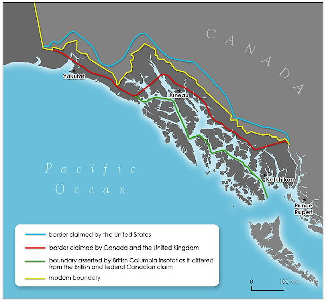
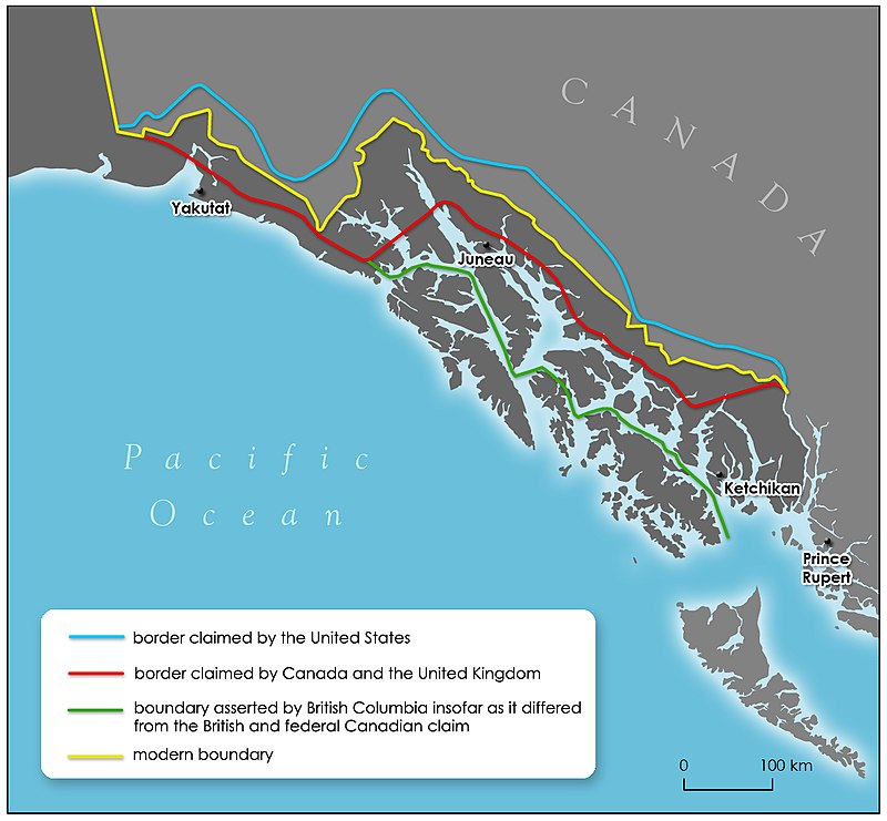
Leaving behind the icy waters of Disenchantment Bay we now began a tour of the various towns situated in the Alaskan panhandle which, by any logic, should have been part of Canada as they are all below the 60th parallel of latitude and west of 141 degrees of longitude. These lands were in dispute between Britain and Russia when the U.S. purchased Alaska and in the end Canada (which was represented by Britain) lost in the arbitration of 1903 because Britain was still trying to improve its relations with the U.S. and didn't fight too hard for the Canadian position.
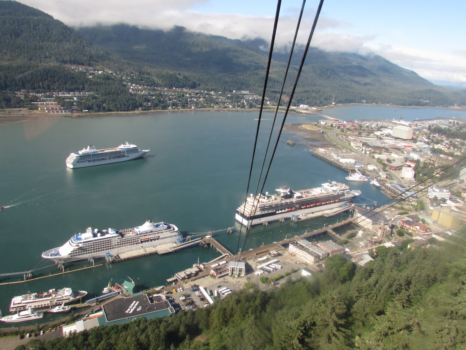
First stop was Juneau, 3rd largest city in Alaska and the unlikely capital. Accessible only by boat or airplane this pretty city of 32,000 is nestled nicely at the base of Mt. Juneau and Mt. Roberts on the Gastineau Channel.
First thing we did after getting off the ship was to take the Mount Roberts Tramway which offered a spectacular view of the city itself, the Gastineau Channel, and the Chilkat Mountains. It also has a nice little nature trail, a native arts gift shop and a rescued bald eagle named Lady Baltimore.
 |
| Aerial View of Juneau |


 |
| Lady Baltimore |
 |
| Alaska State Museum |
We thought we had exhausted the Alaskan museums but there was still one more in Juneau and, true to form, it was just as spectacular as the others with a beautifully presented collection of Arctic artifacts, Russian Alaska, and American Alaska exhibits.
Juneau also has a lovely sea walk and boardwalk filled with shops, restaurants and a new statue of a life sized humpback whale.

Next stop was the infamous Skagway, primary entrance to the Klondike where this journey started. A town noted as much for its saloons, painted ladies, and "Soapy Smith's" confidence men, as it was for supplying all the food, gear, and clothing required by the R.C.M.P. to would be prospectors determined to be part of the 1898 Klondike Gold Rush. Today it's a prettily restored town of colourfully painted storefronts, wooden boardwalks and tourist shops.

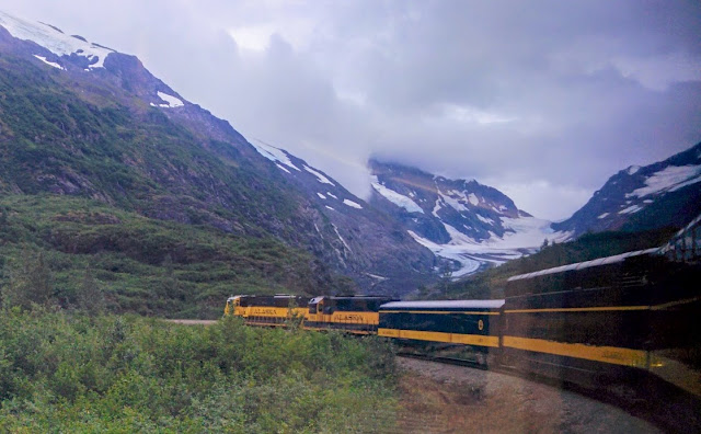
The White Pass and Yukon Route Railway which started construction in 1898, but didn't finish until 1900 when the Rush was over, was the start of a transportation network that continues to this day. We went on a combination tour (bus one way/train return) to the Yukon via B.C. to complete our Klondike journey in much more comfortable conditions than those poor prospectors could have ever imagined.


The journey took us past the beautiful Tutshi and Tagish Lakes and across both the B.C./U.S. and the B.C./Yukon borders and along the way we saw mountain goats and Dall sheep on the hillsides.


On Mile 46.5 of the South Klondike Highway we stopped in at the Yukon Suspension Bridge for lunch and a tour of the interpretive centre. The bridge itself is 200 ft. across and 57 ft. above the Tutshi River Canyon and the entire facility is an amazing structure that cost over $3 million to construct.
After that it was onto the train for a foggy return journey through the Tormented Valley and climbing up to the historic White Pass Summit before heading downhill through tunnels and trestle bridges back to Skagway.

Back into town for some last minute window shopping, photos, and libations before boarding the ship and our next destination.
When we woke up the next morning we were at the Icy Strait Point dock in Hoonah. This was another community that has taken advantage of the Alaska Native Claims Settlement Act, in combination with some local innovation and determination, to build an amazing and thriving tourist destination.


Taking over the historic cannery that had to close in the 1950's due to poor fish runs, the locals converted it to a retail centre and museum, added restaurants and bars, the world's largest zip line, and a range of outdoor activities including kayaking, ATV rentals and whale watching. They even managed to somehow persuade a humpback whale to make the area his year round home so that everyone was always guaranteed a whale sighting. The facilities are beautifully maintained, there's a nature trail loop to explore, and only one cruise ship at a time is allowed to dock at their newly completed cruise ship dock.

Meanwhile life on board the Millennium wasn't too hard to take with all the delicious food, friendly and attentive staff, and all sorts of great entertainment. Nightly shows, live music, and guest lectures occupied most of our time though occasionally we could be found on deck enjoying the passing scenery or snuggled into a favourite corner with a drink and a book.
Then just when we thought we had seen all the tacky tourist souvenir shops this part of the world could offer we arrived in Ketchikan which probably has the most. Nestled in the shadow of the Tongass National Forest it's big on commercial fishing and logging in addition to catering to the cruise ship industry and we did get some good deals on shirts and jackets in the end.
 |
| Ketchikan |


Having spent the past few days cruising through the American side of the Inside Passage it was time now to enter Canadian waters and soak up the sunshine going home.
The familiar waters of Johnstone Strait were filled with fishing boats, orca whales who breached for us, and humpback whales doing a group bubble feast. It was a perfect welcome home and we toasted to a great holiday.


Before we knew we were coming under the Lions Gate Bridge in the early morning hours and docking in our own beautiful city. We had been to the Klondike and beyond, following the well worn path of thousands before us, yet somehow it still seemed like a road less travelled. The vastness and beauty of the North can never be truly grasped but, with the changing climate, a rush of a different kind could very well happen again.


Unbelievable trip, excellent pictures, very educational.. Fanatastic...Loved Tuk.
ReplyDelete