7/29/2023

Where The Bison Roam (July 2023)


An exploration of the prairies wouldn't be complete without considering both the history and the future of its most iconic symbol, the bison. Once numbering in the millions beyond counting, they were reduced to only 1,000 in 1889 after more than 50 million were slaughtered in the 19th century alone by colonists. Critical to the survival of  First Nations plains people, the near extinction of the bison completely upended their way of life and was the catalyst that enabled the government to move them onto reserves and begin the process of converting the prairies to farmland. Fortunately, however, through the efforts of private ranchers, conservation programs, and the establishment of various protective parks, the bison are slowly but surely making a comeback. As part of our tour of the prairie grasslands we planned to visit some of the parks and interpretive centres that are working hard to restore the bison to its former glory, and see for ourselves how the prairies have evolved.


To get to the prairies we of course had to get through B.C. and by far the most pleasant route is via the Crowsnest Highway. There are places to stop for a dip along the way and vineyards with cozy guesthouses, like the one at Cawston, where we could spend a peaceful, stargazing night.

Bromley Rock


Saying goodbye to the Okanagan the next stop was the Kootenays, where my namesake city offered up plenty of refreshment and pleasant accommodation.


The Crowsnest Pass is the lowest elevation mountain pass (1,358 m) south of the Yellowhead Pass, to cross the Rockies on the Canadian side, and is on the border between B.C. and Alberta. A well established First Nations trading route between the plains and mountain people, the CPR chose this route between Lethbridge and Kootenay Landing in 1898 to establish a line that could access the rich coal and mineral deposits of B.C.


Crowsnest Mountain


Of course the scenery is stunning, along with the tragedy of the Frank Slide that ended up killing 90 of the coal mining town's 600 residents when 100 million tons of rock came crashing down at 4:00 a.m. on April 29th, 1903. It was the deadliest slide in Canadian history and the largest until the Hope Slide in 1965.


We were through the Rockies now and soon found ourselves surrounded by the Alberta foothills and our first sign we were in bison/buffalo country. Actually buffalo are a completely separate species of animal native to Africa and Asia. Only Europe and North America have bison, but the two names keep getting mixed up. 


In the Porcupine Hills, just outside of Fort Macleod, is the UNESCO World Heritage Site known as Head-Smashed-In Buffalo Jump. This magnificent interpretive centre preserves and interprets over 6,000 years of Plains People history and their bison culture. For thousands of years the bison provided the Plains People with meat for food, hides for clothing and shelter, bone and horn for tools, and dung for fires. Long before the horse culture developed, the principal means of slaughtering the bison was to stampede a herd over the cliffs and then butcher them at the bottom. Within the centre, films and displays illustrate how the oldest and best preserved buffalo jump in North America operated. 


Visitors can also walk outside around the entire site and try to visualize the incredible team work that went into organizing the hunt. At the base of the cliff are skeletal remains up to 11 metres deep and archeologists have also been able to identify the site of the butchering camp where they discovered remains of meat caches, cooking pits and other cultural highlights. The area on top of the cliffs is still prime grazing land, and the trails below lead to various points of interest including ancient campsites and other bison jumps.


A truly awe inspiring site, and easy to see how the architect of the interpretive centre received the Governor General's award for architecture.


We spent the night in Lethbridge after checking out the High Level Bridge/Lethbridge Viaduct, the largest railroad structure in Canada and the largest of its kind in the world. Built in 1909 to shorten the route to the Crowsnest Pass, it took a 100 man crew two years and 685 railway cars of steel and equipment to complete, and cost over $1 million dollars. Crossing the Oldman River (formerly known as the Belly River) it's a short distance away from the historic battle site known as the Battle of Belly River which, in 1870, was the last major battle of First Nations on Canadian soil. The battle between the Cree (Iron Confederacy) led by Big Bear, and the Blackfoot Confederacy, led by Crowfoot, over the Cypress Hills boundaries led to the death of over 300 Cree. Peace was eventually negotiated and the Cree were given access to the Cypress Hills by the Blackfoot who also adopted the Cree leader, Poundmaker. 


The original prairie grasslands have long since given way to a variety of cultivated crops, and we stared in wonder at the seemingly endless miles of wheat and canola that greeted us at every turn. The beautiful colours of these fields would continue to captivate us throughout our journey, along with a sense of wonder at all the equipment needed to keep everything going. 


While the prairies are certainly quite flat in most places (thanks to the effects of glaciation) they also have sizeable river valleys running through them which, in addition to being a shelter from the strong winds that blow across the mostly treeless landscape, are perfect places to build settlements. Virtually every city of any size is located in one of these river valleys including Medicine Hat on the South Saskatchewan River. It was these various rivers that acted as the highways for Indigenous people and fur traders across the prairies. There are, however, areas where the glaciers never extended, and the most obvious area is the Cypress Hills.


Driving through miles of canola fields studded with enormous wind turbines we slowly started to gain in elevation and, before we knew it, the scenery started to change and we had entered an area where lush forest suddenly appeared. The Cypress Hills plateau rises 200 metres above the surrounding prairie, 600 metres above Medicine Hat, and is the highest point between the Rockies and Labrador. 


Straddling the Alberta and Saskatchewan border, it is viewed as a  prairie oasis and, the 155 square mile Cypress Hills Interprovincial Park in 1989 became the first interprovincial park in Canada. There are more than 700 species of plants and animals living here including moose, elk, deer, beaver, otters, weasel, bobcat, coyote, and mountain lion. At the end of the 19th century it also contained the last of the bison. It's now a very popular camping and hiking area.


The Saskatchewan part of the Park also contains the historic Fort Walsh, headquarters of the North West Mounted Police from 1878-1882 and, from 1943-1968, the breeding and training centre for the RCMP horses. The principal reason for the formation of the NWMP was in response to the 1873 Cypress Hills Massacre which occured 2.5 kms south of the fort. On June 1st 1873, a group of American bison hunters and whiskey traders attacked a camp of Assiniboine, who they mistakenly thought had stolen their horses. The resulting massacre left over 30 men, women, and children dead, not counting those injured and raped, and the country outraged. The NWMP was hastily formed and 275 men were sent out west to maintain law and order. After cleaning up the whiskey traders in Fort Whoop-Up (now Lethbridge) they eventually set up other forts including Fort Walsh where they tried unsuccessfully to bring the perpetrators of the massacre to justice.


But bison weren't the only creatures to roam these lands so, after saying goodbye to friendly Maple Creek, we headed off to Eastend to see the largest carnivore that ever existed, Scotty the T.Rex. There were a few other creatures that caught our attention along the way but they were quickly forgotten when we stepped inside the Discovery Centre.


Scotty is the largest and oldest T.Rex in the world and he was discovered by accident on August 16, 1991 when the local school principal stumbled across a piece of tail vertebrae as he was walking along a trail. Originally built to display Scotty, the T.Rex Discovery Centre not only houses an ever evolving display gallery and a theatre, but it's also a state of the art research lab now operated by the Royal Saskatchewan Museum. Here paleontologists and students work year round on fossils collected during the summer season from the Frenchman River valley and the Cypress Hills. 


A little further east from Scotty and Company is the Grasslands National Park, one of the nation's few remaining areas of undisturbed dry mixed-grass/shortgrass prairie grassland. The unique landscape and harsh, semi-arid climate provide habitat for several unique species including the country's only black-tailed prairie dog colonies, pronghorn antelope, burrowing owls, rattlesnakes, and bison. Plains bison were re-introduced in 2005 after 120 years of absence. Starting with a herd of 71 bison from Elk Island it has now grown to 400-500 and they roam freely over an area of 181 square kilometres (70 square miles) that includes part of the Frenchman River Valley in the park's West Block. A self-guided 20km driving tour through the West Block provides an opportunity to view some of these creatures and the unique landscapes.


It's a vast area that provides an idea of what the prairies looked like before they were transformed into farmland. The odd large boulder left behind by the glaciers provided rubbing rocks for the bison. While the prairie dogs were in abundance and happy to pose for photos, the few bison we saw were off in the distance and only able to be viewed with binoculars. 

Sitting Bull
Crowfoot
Big Bear

This was also the area that Sitting Bull, along with 5,000 Sioux, took refuge in after they had defeated Custer at the Battle of Little Bighorn. At first he met with Crowfoot, the leader of the Blackfoot and then Big Bear, the Cree leader, who both turned down his request to form an army and fight the U.S. government. Then he also tried unsuccessfully to get the Canadian government to give his people a reserve. In the end Sitting Bull and his people stayed here for four years until famine forced them to return to the U.S.


A more modern version of bison roaming over the grasslands are the combines, tractors, and other farm equipment lined up and on display at various equipment dealers or out working the fields.


The other mechanical animal on the prairies is the nodding donkey or pumpjack that appear sporadically or in small herds from time to time, quietly going about their business. Depending on the mineral rights of the landowner, each one of these can bring in between $5,000-$10,000 in annual income.


We stopped in at Moose Jaw to get a photo with Mac, the largest moose in the world and Canada's most photographed roadside attraction.


When we pulled into Regina, one of the first things we saw was the striking First Nations University of Canada, a federated college of  the University of Regina with a design that perfectly encompasses the Plains People culture and was designed by the Indigenous architect Douglas Cardinal who also designed the Canadian Museum of History. The First Nations University provides an opportunity for both Indigenous and non-Indigenous students of all nations to learn in a unique environment of First Nations cultures and values. As more and more universities are now offering Indigenous studies courses, we can only hope that slowly but surely a better understanding of the third solitude (the other two being the French and English) will start to permeate the conciousness of the Canadian public.


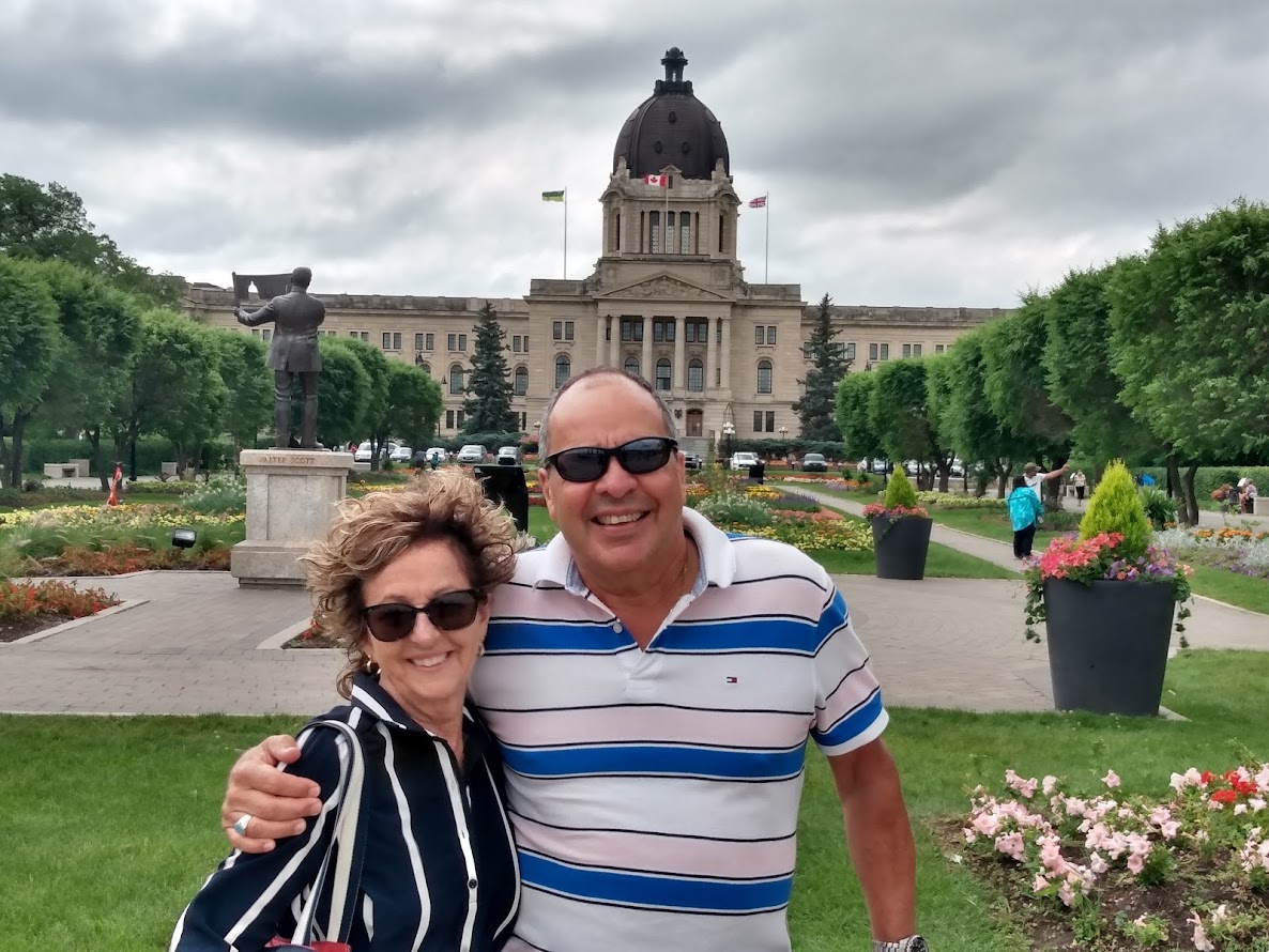
Regina has the pleasant Wascana waterfront park, the 4th largest urban park in Canada and more than twice the size of Vancouver's Stanley Park. Wascana is derived from the Cree word Oscana, meaning "pile of bison bones", which is what was lying around the creek at the time of settlement. It now encompasses the Saskatchewan Legislative Building, the University of Regina, the Mackenzie Art Gallery and the Royal Saskatchewan Museum in addition to an outdoor aquatic centre and miles of pedestrian and cycling paths.


The Royal Saskatchewan Museum has a fantastic life sciences gallery showcasing the animals, eco-regions, and the seasons, a T. Rex gallery with a copy of Scotty, and a First Nations gallery highlighting Indigenous culture along with an honest and detailed examination of the numbered treaty process.


Regina is also headquarters to the R.C.M.P., our tarnished national police force, which this year is celebrating its 150 year anniversary. Unfortunately, there was no acknowledgement of their past mistakes, or complicity in the mistreatment of Indigenous people at their Heritage Centre, just a glorification of their checkered history. Their continued misogynistic attitude towards their own female members, systemic racism, cover-ups of police bungling, and a complete lack of success in dealing with the over 1,000 missing and murdered Indigenous women, points to a force that is broken and in need of a complete re-set. 


Saying goodbye to Regina we then made our way to historic Fort Qu'Appelle.


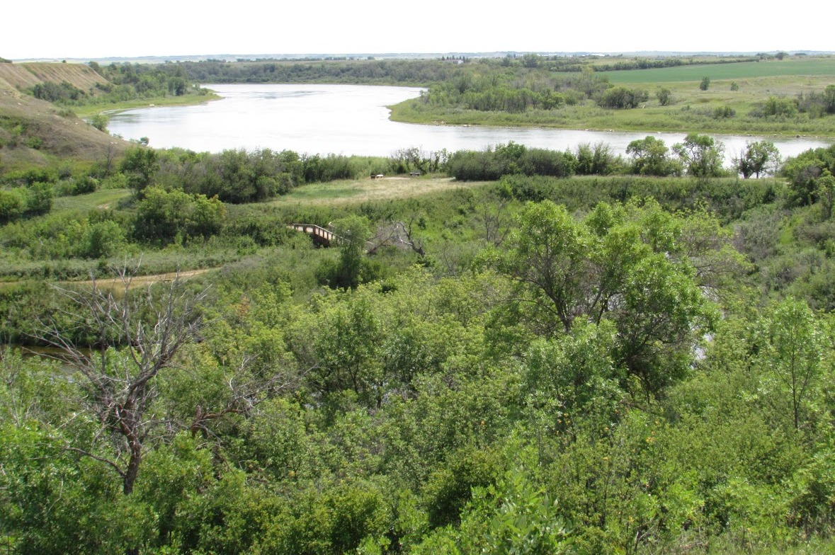
Strategically located at the crossroads of many historic Indigenous trader and hunter trails, this important hub in the Qu'Appelle valley  became a Hudson Bay Company post in 1852. The Qu'Appelle River flows east from Lake Diefenbaker in southwest Saskatchewan for 430 km to join up with the Assiniboine River in Manitoba. In the lower Qu'Appelle Valley the river flows through 6 major lakes; Pasqua, Echo, Mission, Katepwa, Crooked, and Round Lakes. Qu'Appelle, in French, means who calls and comes from the Cree Kah-Tep-Was, that means "river that calls" and the origin of this name is from the Pauline Johnson poem "Legend of the Qu'Appelle Valley" which tells the story of a young man paddling home from a hunting trip where his betrothed is waiting. He hears a voice calling his name and replies, "Qu'Appelle?" but hears no answer, only the echo of his own voice. When he arrives at his village he discovers his fiance has died and it was her who had called out to him with her last breath.


On September 15th, 1874, Treaty 4 was made between the Queen and the Cree, Saulteaux, and Assiniboine living in the area, and signed at the HBC outpost of Fort Qu'Appelle. The reason for this was because in 1763 King George III issued a Royal Proclamation that all lands west of the Appalachian Mountains were an Indian Reserve and outlawed the private purchase of Native American land. All future land purchases were to be made by Crown officals and had to be agreed to by the Indians at a public meeting. When the 13 Colonies broke away from Britain and formed the United States, they of course ignored the Royal Proclamation and simply slaughtered the Indians and settled their land. When Canada came into being it was still obliged to adhere to the Royal Proclamation and so, if it wanted to settle the prairies and build a railway across the country, it had to find a way of getting the First Nations to give up their sovereignty over the land. Numbered treaties were created and presented to the First Nations that said, in exchange for giving up title to the land they would be given reserves to live on and they could continue to hunt, fish, and trap on non reserve land. Amongst other things they were also promised schools, agricultural implements, animals, seed, and training to start farming, and a $5.00 annual payment. Of course the First Nations couldn't read the text of the treaties they were being asked to sign and had to rely on an oral explanation, which obscured the truth. However, Chief Pasqua did create a pictograph that showed the Indigenous interpretation of the treaty, the only one ever made. Following the signing of the treaty each chief was then given a commemerative medal. 


The statue outside the courthouse commemorates the Treaty 4 negotiations and the various chiefs involved.


Numbered Treaties Map


Fort Qu'Appelle is also where the first residential school was built and the last one to close, and it was located in nearby Lebret. Instead of providing schools on the reserves as promised in the treaties, residential schools were established by the federal government and run by the Church. The gate is all that remains of the school after it was closed in 1969 but, like all of the schools that were in operation, the after effects of all the trauma the children endured (physical & sexual abuse, overcrowding, malnutrition, humiliation) will go on for many more years to come.


Stopped in at Grenfell, where my Mom and her family had all grown up and which still has a few remaining relatives. Sadly the old farmhouse and all the original buildings are crumbling away now in the manner of most prairie farms, as the process of consolidation continues and farms get larger and more mechanized.


Canola is obviously one of the most popular crops being grown on the prairies and Canada is by far the world's leading producer but, as the alternate green and yellow fields indicate, it cannot be grown two years in a row on the same soil. Other crops include wheat, barley, flax, and hay but are now increasingly including pulse crops such as lentils, peas, and chick peas. More than 8 million acres in Saskachewan and Manitoba now produce more than 30% of the world's lentils and peas in addition to chick peas and dry beans.


Following the signing of the first numbered treaties, the federal government in 1871 began the Dominion Land Survey in an effort to divide up the prairies into square mile sections for mostly agricultural use. Provinces were divided into numbered townships and each township was made up of 36 square mile sections (640 acres) which, in turn, were divided into quarter sections. Homesteaders like my great grandfather and my grandfather would pay $10.00 for a quarter section which they would gain title to if, within 3 years, they had built some sort of a house on the property (usually a sod house) and cultivated at least 30 acres. As their farming efforts succeeded they would expand to the next quarter section, with the eventual goal being to accumulate a full square mile/640 acre section of land. My great grandfather got his first quarter section in 1884 and by the time he died in 1929 he and his son had accumulated 6 quarter sections.

Typical Sod House


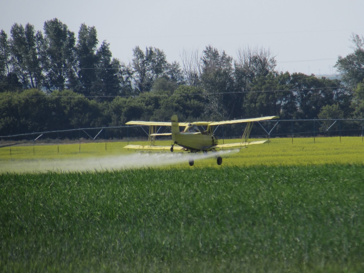
The Dominion Land Survey is the world's largest survey grid laid down in a single integrated system and encompasses over 310,000 square miles. While homesteads were still available in the 1950's most of the land had been settled by 1914. If you were to drive down the highway in the 1970's-1990's you would see a farmhouse just about every mile. But now, with increased mechanization and the consolidation of family run farms in order to be profitable, you would be lucky to see a farm house every 10 miles. Instead of 640 acre farms they are now averaging 4,000 acres and all you see are clusters of large storage bins and equipment sheds. 


Even more massive are the new grain elevators that pop up along the railway lines with miles of cars waiting to be loaded. The logistics of planting, fertilizing, and harvesting all this grain never mind getting it to market at a fair price is not for the faint of heart, and nothing my great grandfather would recognize.


On now to Manitoba and the city of Winnipeg where, amongst other attractions, is the amazing Museum of Human Rights, the only national museum not in Ottawa. Such a unique design on the outside and then on the inside the beautiful staircases made of alabaster. On the main floor are multimedia presentations and projections with a particular focus on Indigenous perspectives and, as you climb up the various levels you can examine artwork with a focus on human rights and view displays focusing on other areas of the world where human rights were violated. Finally at the top, in the Tower of Hope, you can take in the panoramic views of the city.


The Forks is always a fun place to check out and stop for lunch, and later we also went over to revisit the Upper Fort Garry Park, another historic HBC fort and administrative centre, before popping into the HBC archives. Donated by HBC to Canada they represent over 300 years of historical records from 500 Company posts and encompass 10,000 volumes that have been microfilmed and made available to the general public.


Manitoba Archives

But the main new attraction was the 
Qaumajuq addition to the Winnipeg Art Gallery (WAG).  After years of construction, the world's largest collection of Inuit art is now on display, and what a showcase they have created to present the thousands of carvings in both the gallery and in the visible vault.


Then for something different we took a day trip out to Gimli, a small town on Lake Winnipeg that was founded by a community of Icelanders and is a great place for fish and chips.


As part of our continuing search for where the bison roam, we decided to visit Riding Mountain National Park which has a special area called the Lake Audy Bison Enclosure. Here another small herd of 40 plains bison have developed from an original herd of 10 bison from Elk Island. The Park sits atop the Manitoba Escarpment and is a forested area that stands in sharp contrast to the surrounding prairie farmland. Three different ecosystems converge in the area; grasslands, upland boreal, and eastern deciduous forests, and the park is a popular location for camping, swimming and hiking. Animals of all kinds roam throughout the park including; wolves, elk, beaver, moose, white tailed deer, and cougar. Wasagaming is the commercial centre.


This time the whole herd of bison came out to say hello as we drove through the reserve and things got a little exciting when a bull jumped out of the forest right in front of our car.


As we left this part of Manitoba it was interesting to see that, in spite of the changing geography with its forests, small lakes, and a more undulating terrain, the farms were still able to raise the same crops of wheat, hay, and of course canola. The prairie landscape never looked prettier.


Back in Saskatchewan we got a chance to check out another section of the beautiful Qu'Appelle Valley and go for a swim in Crooked Lake.


On the way to Saskatoon we passed by some early blooming fields of flax which were blue in colour. A nice contrast, though there were so many pretty fields and no two were the same. So much for featureless flat prairie.


There was another feature of the Saskatchewan landscape that would occasionally pop into view, and that was a potash mine. Potash refers to materials or compounds bearing potassium and is used primarily for making fertilizer. In 1951 potash was discovered in Saskatchewan while drilling for oil, and it is now the largest producer of potash in the world with 30% of the total production and 50% of the known reserves.

Potash mine in Lanigan, Saskatchewan


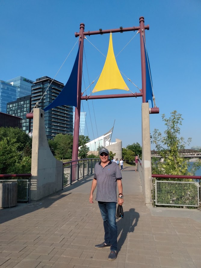
After a long day of driving to Saskatoon we were in need of a little refreshment before starting our exploration. Our hotel was located right on the South Saskatchewan River and steps away from the Meewasin Valley Trail which was a lovely walkway alongside the river.


The campus of the University of Saskatchewan was a beautiful collection of faculty buildings and, not surprising, it's a world leader in water and food security, vaccine development and infectious diseases, and human, animal and environmental health. Nothing brings humans and animals closer together than farming.


Saskatoon was also the perfect launching spot to visit the historic site and interpretive centre of Batoche, by following the Louis Riel Trail/Hwy11. Riel had always been vilified as a traitor in the history we were taught in school, but now he is recognized as a founding father of the Province of Manitoba and a fierce advocate for Metis rights. After initial victories at Duck Lake, Fish Creek, and Cut Knife, the uprising he and Gabriel Dumont led all came to an end at the Battle of Batoche, with Big Bear and Crowfoot going to prison, Gabriel Dumont going into exile in the U.S. and Louis Riel being hanged. When Gabriel Dumont was pardoned he came back to Batoche and was buried there, overlooking the Saskatchewan River, when he died in 1906.


The road continues to Prince Albert and beyond, to Prince Albert National Park, and yet another bison refuge known as the Sturgeon River herd. Started once again from 50 Elk Island bison in 1969, the herd reached 450 animals until they were infected with anthrax and all but 120 died. Today the herd is recovering but, because they are the only free ranging herd in Canada, they frequently roam outside the protected area which allows them to be harvested by hunters, so their recovery is slow. In addition to the bison, the park is home to white-tailed deer, bears, wolves, and moose amongst other creatures. It also contains a number of lakes including Waskesiu Lake, a popular place for campers, swimmers, and hikers.


Saskatoon is also home to the Wanuskewin Heritage Park, an archeological site and cultural and historical centre of Northern Plains First Nations including; Cree, Assiniboine, Saulteaux, Atsina, Dakota, and Blackfoot. Wanuskewin in Cree means "being at peace with oneself" and the award winning Interpretive Centre is a beautifully designed facility with a series of galleries, exhibits, and presentation spaces showcasing Plains culture. In the park itself, on the shore of the South Saskatchewan River, is a 7 km series of trails that invite visitors to enjoy the views and explore, amongst 19 points of interest, the ancient bison jump, a stone medicine wheel, and the bison pound. In partnership with Parks Canada, bison were introduced in 2019 as part of an effort to restore the plains bison and the native grass habitat. The animals came from the Grasslands National Park and Yellowstone National Park.


No road trip worth its salt would be complete without a little drama, and sure enough we had a mechanical breakdown just as we were getting ready to leave Saskatoon. But between the towing company and the car dealers in Saskatoon and Edmonton we got it all sorted out and a crisis was averted. Nothing money and a cold beer couldn't fix.


Now it was off to Edmonton where we were lucky to be staying right downtown just off the North Saskatchewan River which offered a nice walkway to stretch our legs. It was Junie's birthday so we made sure to find a nice restaurant to celebrate, and could also take in a little of the buskers festival.


We also took in the funky area known as Old Strathcona which was filled with shops, pubs, restaurants, theatres, and a tattoo parlour for Junie.


We were also within walking distance of both the Art Gallery of Alberta and the Royal Alberta Museum. Both of them boasted very unique architectural designs and showcased very impressive displays, particularly the museum with its focus on Indigenous culture. It seems as if every single museum and gallery across the prairies is making a conscious effort towards reconciliation.


Unfortunately, we couldn't get to Elk Island National Park outside of Edmonton which has the densest population of hoofed mammals in Canada including; bison, moose, mule deer, elk, and white-tailed deer. Elk Island has played a key role in bison conservation since 1907 when the Canadian government bought one of the last remaining herds from Montana and located most of them in Wood Buffalo National Park in the NorthWest Territories. A smaller amount evaded capture and became the ancestors of the existing herd at Elk Island which now maintains a herd of 400 plains bison and 300 wood bison. Elk Island has become famous for exporting its bison and other ungulates to other conservation areas in North America.


Next stop was Drumheller and the Royal Tyrrell Museum which has the most incredible, over-the-top collection of dinosaur fossils in Canada and is on the top 10 list for the world. The 135,000 sq ft. facility, which is a museum and palaeontology research facility, contains over 160,000 fossils, 800 of which are on permanent display, and over 30 mounted skeletons. Drumheller itself is located in the Dinosaur Valley of the Alberta badlands which is 2km wide and 28km in length and features a uniquely sculpted terrain with layers of sedimentary rock and hoodos.


Everytime I'm confronted with dinosaurs I can't help but think about our pathetic 200,000 years of human development and a mere 11,000 years of something approaching civilization compared to the hundreds of millions of years these creatures existed until a meteorite hit the Earth and wiped them out. What would the world look like if that hadn't happened and what would it be like if it happened again?


It was time to say goodbye to all the bison, dinosaurs, and canola and start heading home in spite of all the wildfires raging throughout the Province and the smoke ruining the mountain views. Stopped in at Golden to check out the Skybridge facility, Canada's two longest and highest suspension bridges 426 feet above the canyon, plus ziplines, a roller coaster, climbing walls, a treetop village, and a canyon swing. Plenty to make you swoon but a lot of fun for everyone as well.


Stopped in at Kamloops for our final night to visit with friends and to take a moment to reflect on the shameful legacy of the residential school system. Kamloops had the largest residential school in Canada and in 2021 it was the first to discover unmarked graves on its property using ground penetrating radar.


On our journey through the prairies we saw how a landscape had been completely transformed but, in spite of that, has developed a new kind of beauty particularly with its fields of canola. As a country we have a long way to go in addressing how this change affected the First Nations and Metis who lived here and how their lives were completely changed in the process. We should have been more gracious in how we treated them and shown a little more understanding in what they were experiencing. We certainly didn't have to be so cruel. Slowly, and at considerable expense, efforts are finally being made to rectify some of these wrongs and bring about reconciliation and at the same time the bison are beginning to make a comeback. Perhaps it's a coincidence these two paths are occuring at the same time or perhaps it isn't, but the Indigenous plains culture was always inextricably tied to the bison and it's certainly fitting both are on the rise together.


No comments:

Post a Comment