
The Maritimes (Prince Edward Island, Nova Scotia & New Brunswick) and Newfoundland make up what are referred to as the Atlantic Provinces and are both the oldest and newest members of the Canadian Federation with the colonies of Nova Scotia and New Brunswick becoming founding members in 1867, Prince Edward Island joining in 1873 and Newfoundland finally in 1949. The area has a rich history of competing French and English interests, not to mention the role it played in the emerging United States of America, and these developments have helped shape a unique culture on Canada's Eastern seaboard. This is what we had come to explore and we were richly rewarded by the beauty of the landscape and the graciousness of the people who lived there.


It all starts in Halifax, a town originally established by the British Governor Edward Cornwallis in 1749 with 2,500 settlers to counter the French fortress of Louisbourg in Cape Breton. However, this was in violation of the treaties with the indigenous Mi'kmaq who strongly opposed the British presence and subsequently kept up a series of raids on the settlement over the next few years in spite of a bounty he proclaimed for the scalp of any man, woman or child. The strategically positioned Citadel Hill was one of the fortifications built at the same time to help guard against the attacks and it remains a National Historic Site to this day with a great view of the downtown and waterfront.


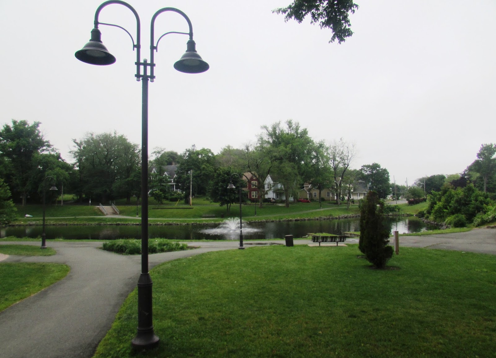
Besides being the capital of Nova Scotia, Halifax is also the headquarters of the Royal Canadian Navy's Atlantic Fleet. Yet in spite of the thousands of naval personnel stationed here, it's the even greater number of tourists enjoying the 3 kilometre boardwalk with its museums, shops, restaurants, galleries and other attractions that makes the waterfront such a lively place.


A less lively place was the Old Burying Ground, an historic cemetery also founded in 1749 and containing the graves of over 12,000 Halifax people, famous and not so famous, including loyalists, blacks, naval officers and soldiers from all the various wars including the Napoleonic Wars, the American War of Independence, the Invasion of 1812, and the Crimean War, of which the triumphal arch is the only monument to the Crimean War in North America. So much history here and so much of it already forgotten.

It was the Treaty of Utrecht in 1713 (a settlement reached to end a European war between France and Spain on the one side and Britain, the Dutch and Austria on the other) that made France cede the Hudson's Bay region, Newfoundland and Nova Scotia to Britain, but not what is now called Cape Breton or Prince Edward Island or New Brunswick which was still part of the French colony of Acadia. It would take another 50 years, a few more battles, and some serious disruption of the existing inhabitants before all of the Maritimes came under British control.


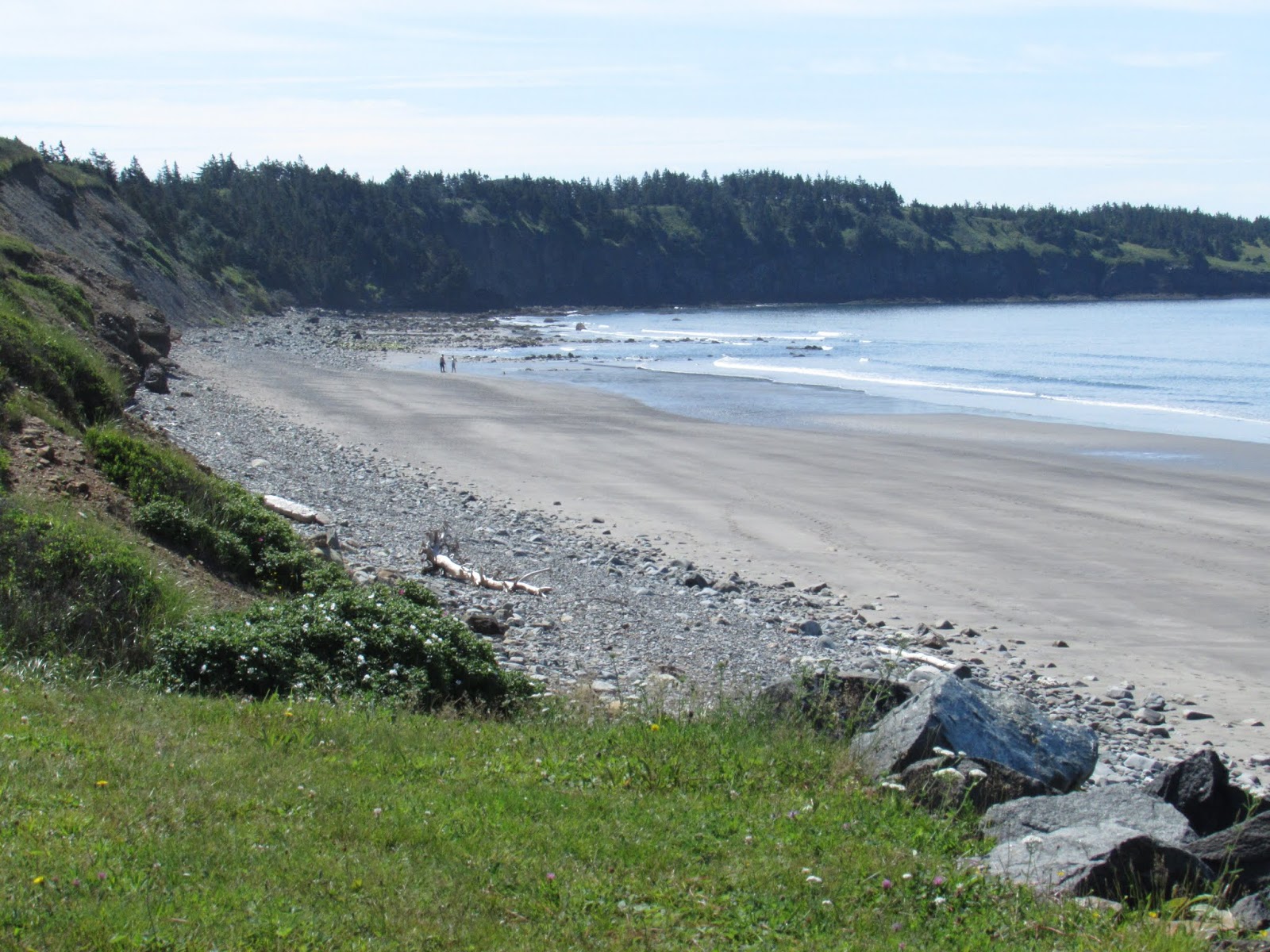
We began our exploration of the Maritimes by following the coastline of the Eastern shore and at Clam Harbour beach we got our first taste of the beautiful white sand and clear ocean water of the Atlantic even if it was a bit windy and cold.


As we continued along the nearly empty highway we passed one picturesque village after another nestled into little coves and filled with pretty waterfront cottages, but they were strangely silent and many of the homes seemed vacant. Clearly this area hadn't recovered from the collapse of the cod fishery in 1992 and subsequent loss of over 20,000 jobs. But where people were active they were often very creative with how they decorated their front yards.


Every village has at least one church and usually there was a graveyard attached to it. Also the church and graveyard were always located on a spot with the best view. We saw so many of these graveyards that we joked there were more people dead than alive in this area which, I suppose after more than 200 years, would certainly be the case.


Prior to 1955 the island of Cape Breton was only accessible by boat but, in 1952, the government decided to make a connecting road by filling in the narrow Canso Strait with a causeway. It took 3 years and 10 million tons of rock to complete the job but Cape Breton was now connected by land to the rest of Nova Scotia. Another benefit to the area was the eastern side of the causeway was now ice free during winter. After crossing the causeway we arrived in Port Hawkesbury where comfortable accommodations and great seafood greeted us.


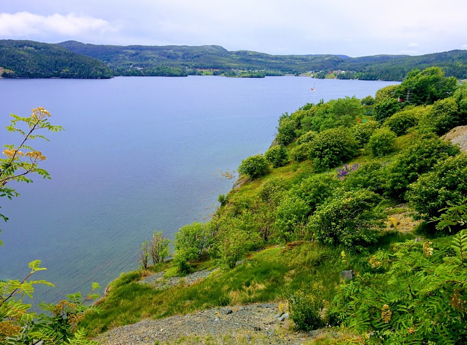
The road to Sydney goes alongside the Bras d'Or Lake, an inland sea that is a mix of fresh and salt water with openings to the ocean in the North, by the Boularderie channels, and in the South, by the canal at St. Peters.


At roughly 1,000 square kilometres in area, the lake occupies a good portion of the centre of Cape Breton Island and provides miles of campgrounds along its shore and boating and fishing opportunities in its waters. Like all of the Maritimes the drive is very scenic with low forested hills and water always close at hand.


In 1754 the so-called French and Indian War began with French and English settlers and their respective Indian allies fighting with one another but, when the 7 Years War in Europe began in 1756, it greatly expanded in scope. By 1758 the British had laid siege to and captured Louisbourg. From there they used it as a base for taking Quebec and, by the time the war was over and the Treaty of Paris signed in 1763, France was out of the New World with the exception of the islands of St. Pierre & Miquelon off the coast of Newfoundland and the island of Guadeloupe in the Caribbean. Cape Breton, New Brunswick and Prince Edward Island were now part of British Nova Scotia.


In spite of Nova Scotia being given to the British in 1713 by the Treaty of Utrecht only 5,000 British and Protestant settlers had come to live there by 1755 while, in contrast, there were more than 8,000 Acadian settlers, descendants of the original French colony of Acadia that included the modern day Maritime provinces. Concerned about Acadian resistance to British rule the Nova Scotia government decided to expel the Acadians and 6,000 of them were rounded up in 1755 and expelled to various parts of the American colonies. The remainder went into hiding or fled to New Brunswick and Prince Edward Island.

This was the first wave of the expulsion and the second wave of the expulsion came after the fall of Louisbourg in 1758 when another 4,000 Acadians from Cape Breton, New Brunswick and Prince Edward Island were deported back to France and Britain and a few thousand escaped to Quebec. Some of the Acadians returned to Louisiana and later became known as Cajuns. The expulsions were a humanitarian disaster with thousands of people dying of hunger and shipwreck while all of their property was confiscated and given to new settlers from the American colonies.

Throughout our travels in the Maritimes we would see houses adorned with the Acadian flag or just the 5-pointed star that indicated the people living there were of Acadian heritage and a living rebuke to another shameful chapter of Canadian/British history.


Sydney is the historic capital of Cape Breton with a strong commitment to Celtic music and culture as evidenced by the Big Fiddle statue on the waterfront boardwalk and its Irish pubs. The stately homes and parks that bookend the town are a reminder of better times when the city was the centre of steel making and coal mining until both these industries shut down in 2001. Conveniently located close to the Fortress of Louisbourg and the Cabot Trail, Sydney is now trying to focus on tourism and culture. A poignant monument to the sailors of the merchant marine who lost their lives during the Second World War is a reminder of the major contribution the area made to the war effort.


It was one breathless viewpoint after another as we circumnavigated the Highlands but we did stop for a nice hike at Skyline Trail, one of 26 that have been laid out within the Park that provide opportunities to view wildlife and, in this case, a dramatic headland overlooking the Gulf of St. Lawrence.


A beautiful day that had us thirsty and hungry for fish & chips at the Rusty Anchor in Pleasant Bay before continuing to Antigonish.


Antigonish is another pretty little university town conveniently located at the start of the Sunrise Trail which is a scenic roadway that goes along the Northumberland Shoreline.


The Northumberland Shore reportedly has more warm water beaches than any other part of Atlantic Canada not to mention gently rolling farmland, picnic/park sites, sand dunes, and the Tatamagouche brewery.


The Sunrise Trail ended conveniently at the entrance to the Confederation Bridge, a 13 kilometre engineering marvel that links Prince Edward Island to New Brunswick and is listed as the world's longest bridge over ice-covered water. Built to withstand impact with icebergs the bridge cost over 1.3 billion and was completed in less than 4 years.


A little intimidating as we drove over the rather narrow deck partially shrouded in fog and mist and high above the ocean but it was the quickest way to the Island and from there it was a short hop to Charlottetown, the capital.


Brick buildings dominate historic downtown Charlottetown and they are filled with shops, bars, and restaurants. Lots of al-fresco dining and live music off the main street which is closed to traffic. There is also a waterfront walkway with even more places to choose from.


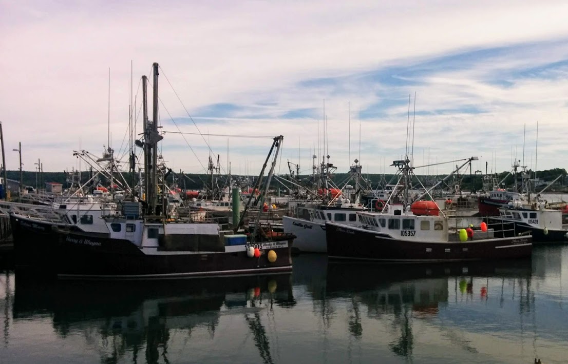
The second most important industry in PEI is fishing and lobster fishing in particular. Here the local fishermen explain that, with the near extinction of the cod fishery, the lobster have flourished with so few predators.


Said goodbye to Charlottetown, the so-called Birthplace of Confederation and, after driving to the other end of PEI, we got on the ferry back to Nova Scotia. It was a beautiful crossing but it took 75 minutes compared to the 15 minutes or so to go over the bridge so it wasn't hard to understand why the folks were so happy to have a bridge linking them to the mainland 120 years after they joined Canada.


Next stop was Truro, referred to as the hub of Nova Scotia because of its railway junctions but to the original Mi'kmaq it was called Wagobakatik which means "end of the waters flow". This is because the Bay of Fundy ends here and, as the tide comes in, it also creates what is known as a "tidal bore" where it pushes the waters flowing into the ocean back upstream like a mini-tidal wave. To really get an appreciation of the famous Bay of Fundy tides we went to Burntcoat Head, where the official highest tides in the world are recorded.


As we drove along the coast to Burntcoat Head with the tide going out we could already see the estuaries drying out and exposing the thick red mud that makes up much of the soil in the Maritimes.


Approximately every 6 hours the tide is either flowing in or out of the Bay of Fundy which ends up moving 100 billion tons of water every 12 hours or twice as much as the combined total flow of all the rivers in the world. The power of this is equivalent to 8,000 train engines or 25 million horses, and that's what I call truly awesome. While the highest tides in the world have been recorded here (with an average of 47.5 feet and up to 53.5 feet) it is the low tide that gets everyone excited because that's when you get a chance to walk around on the ocean floor and look up at the cliffs to see how much of a drop there is. This is one place where you don't want to get caught out when the tide is coming back in.


Lots of pretty farming scenery in the area as well but the main attraction after all the excitement was great food and libations at the Nook & Cranny.

Saying goodbye for a bit to Nova Scotia we drove through New Brunswick to St. John where we arrived in the middle of a busker/music festival.


While the downtown is quite small the key attractions are all nicely connected with the King's Square park across the street from our hotel leading straight to the City Market entrance that, in turn, connected with a shopping mall, aquatic centre, some hotels, restaurants and the waterfront.


Another town with lots of historic brick buildings that have been restored and are now filled with restaurants and bars that support a lively evening scene.


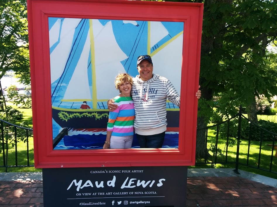
Got into Digby nice and early so we decided to explore up the Digby Neck area before having lunch. A very picturesque peninsula dotted with little villages. First stop was to check out the replica house of Maud Lewis, the tragically famous folk artist whose original home and some of her art is on permanent display in Halifax.


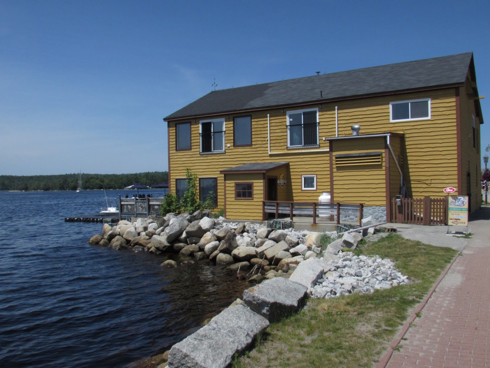
Back in Digby, the self-titled Scallop Capital of the World, we settled in at the Sydney Street Pub, which specializes in the local seafood and beer, for a delicious lunch before tackling the rest of the town.


While Digby is first and foremost a fishing village the other governing factor is of course the Bay of Fundy tides. When they go out the fleet is often left high and dry or close to it and the speed at which it moves is quite disconcerting.


And of course there are lots of restaurants serving up the local catch each day and where you can watch the tide coming and going with a regularity that is in perfect sync to the rotation of the moon up above.


Being on the ocean edge also means having to deal with the fog rolling in and out throughout the day as temperatures fluctuate.


Leaving Digby for Yarmouth the tide was out and it provided lots of fascinating and colourful photo opportunities along the way with picturesque coves and fishing villages around every corner.
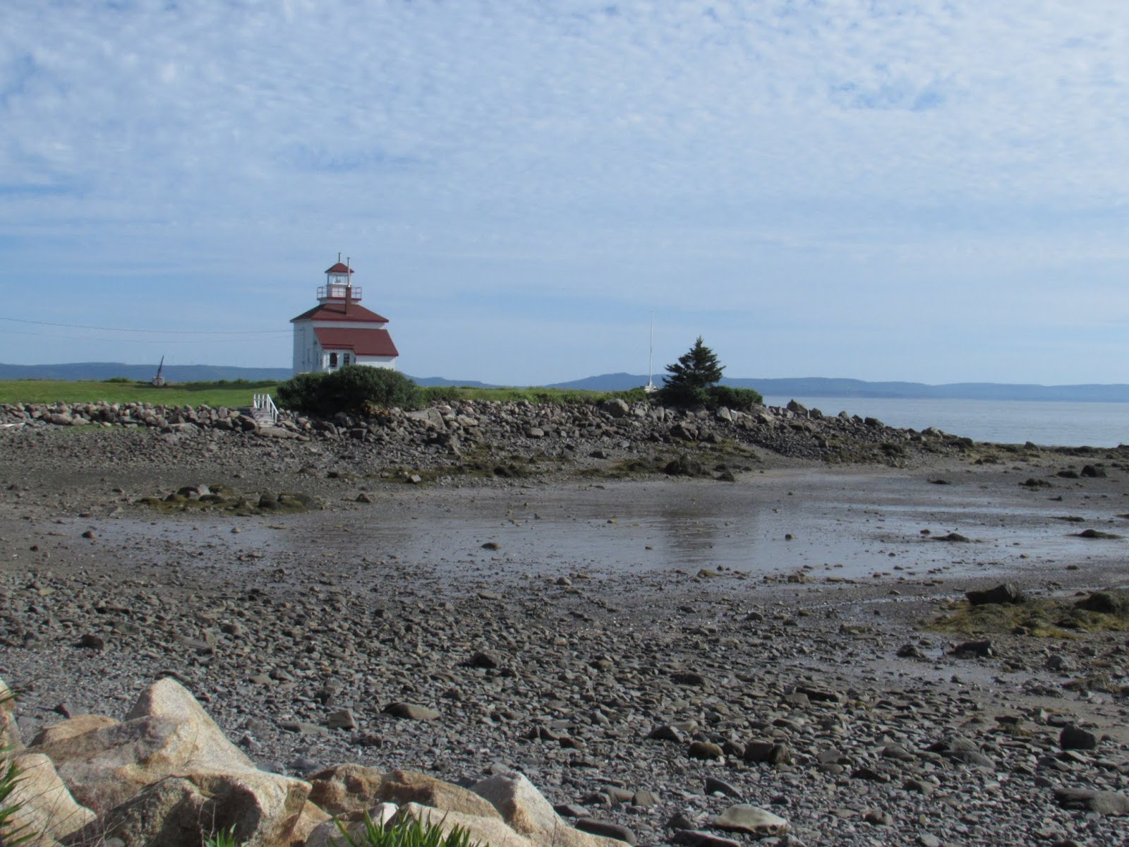


We were on the Lighthouse Route now, though it's very hard to find any stretch of the Maritimes in general, and Nova Scotia in particular, that doesn't have a lighthouse.

Cape Forchu (named by Samuel de Champlain as the forked cape) in particular offered a great view, some pleasant walking along the Leif Erikson Park & Trail, sandy beaches, and the Keepers Kitchen restaurant patio with perfectly timed food and libations to enjoy at the "apple core" lighthouse itself, the 2nd most photographed lighthouse in Nova Scotia.


Located in the heart of the world's largest lobster fishing grounds Yarmouth lands the most lobster of any place in Canada. Originally settled by the Acadians in 1750 it has evolved over the years from a major shipbuilding centre to a railway/steamship terminus and now a ferry connection to the U.S. It also contains some great examples of Victorian architecture, a historic legacy of the wealthy captains and merchantmen of an earlier age. But it was the modern brewpubs and seafood that interested us the most when we first arrived for the annual Seafest weekend.


The main street was closed off for a classic car and hot rod rally that provided a colourful parade on the first evening and the next day a chance for the whole town to get up close and admire some beautifully preserved cars from an era that is sadly over.


On our final leg back to Halifax along the Lighthouse Route we came across a replica lighthouse at the Seal Island Lighthouse Museum in Barrington. Here the original Fresnel lens of the Seal Island Lighthouse is on display and the reason the museum was created in the first place which was to preserve a piece of local history that was responsible for saving countless lives over the years. For more than 300 years storms, fog and powerful tides have led to more than 160 shipwrecks off the coast of Seal Island. In 1823 two families from Barrington settled there as a base for their fishing and ended up providing shelter to shipwreck survivors. In 1831 a lighthouse was constructed and it remained staffed until 1990. For 76 years the lens was in use and, because of its significance, when the local communites learned in 1977 the lens was going to be relocated to the National Museum of Science & Technology in Ottawa, they mounted a campaign to build a half size replica that would house the lens and other artifacts locally. Great place to tour the inside of a lighthouse and it also offers fabulous views from the top.


In need of some refreshment we stopped in at Shelburne itself where, coincidentally, they were having their annual Founders Day celebration in the historic district by the waterfront. The Mi'kmaq, whose land this was before any settlers arrived (and with whom the signed treaties were finally enshrined in the Constitution Act of 1982 and formally recognized by the Supreme Court of Canada in 1985) exist in the same uneasy peace within Canada as other First Nations groups do as a result of the residential school trauma, forced changes to their way of life, and disputes over natural resources. It was Nora Bernard, a Mi'kmaq activist, who led the original class action suit (on behalf of 79,000 residential school survivors) that went on to become the largest in Canadian history.


There were lots of other lighthouses to check out including the Fort Point Lighthouse in Liverpool, Nova Scotia's 3rd oldest, and of course Peggy's Cove which we had visited previously but there were also some amazing white sand beaches, like the one at Beach Meadows, which had to be sampled.


It was time now to say goodbye to the Maritimes themselves and, after a last night in Halifax, catch a flight to Newfoundland or "The Rock" as it is affectionately called. As soon as you arrive in St. Johns you are greeted by a significant piece of rock called Signal Hill which, in addition to offering the most amazing view of the city, also hosts historic harbour fortifications, the Cabot Tower, and the original Marconi wireless station where the first wireless transmission from Europe was received in 1901.


There is also the 1.7 kilometer North Head Trail to follow down to where the whales can be seen going about their business but the even better whale watching is around the corner at the Cape Spear Lighthouse and National Park.


The local "Hop On Hop Off" bus service was a great way of getting around to see where the local attractions were and to pick up some local history knowledge.

One of the nicest history lessons came from Chief, a beautifully dispositioned Newfoundland dog and unofficial greeter to all the tourists. The origin of the Newfoundland breed of dog is something of a mystery though, along with the Labrador, they have common roots in the St. John's water dog and probably have a little mastiff from the early Portuguese fisherman dogs. Nonetheless they are famous both for their even temperament and as a rescue dog.


Another local attraction is The Rooms, a strikingly modern art gallery, archives, and museum for the Province that is located on a hill overlooking the city and offering fantastic views of the harbour and downtown area from its restaurant.


St. John's is most famous for the busy Water, George, and Duckworth streets where the number of lively Irish pubs and colourful bars and restaurants have given it the distinction of having the most bars per capita of any place in Canada.


And as for colour, nothing can compare with the "Jellybean Row Houses" of every colour that line most streets, particularly Gower Street.

While waiting for the evening to begin it's best to spend the daytime out exploring the beautiful countryside, and there is no better place to begin than the spectacular Cape St. Mary's Ecological Reserve. Following the sometimes foggy and misty Irish Loop, with its green forests, and then past the occasional fishing village and through the windswept barrens of the Cape Shore you arrive at the end of the Avalon Peninsula.


As we made our way past Bird Rock Cove, and the impossibly blue ocean water, we could smell the birds before we saw them. Walking along the carefully marked pathway, that followed the terrifying cliff edge, we finally came upon Bird Rock where they were all gathered. More than 70,000 seabirds of various species including, Gannets, Murres, and Kittiwakes were clustered on Bird Rock and the adjacent cliffs with each species settled onto its own particular niche. The whirling cacophony was almost deadening, but the beauty and immensity was even more overwhelming. What an experience. Established in 1983 as an Ecological Reserve there is probably no place on Earth where you can get closer to a seabird colony.


The pretty wildflowers everywhere were also more than worthy of a photo.

On the way back to St. John's as we continued up the Cape Shore coastline where we were treated to more stunning vistas and impossibly beautiful blue water. Luckily we also found a place serving fish and chips and local beer.


There are a few curiosities in Newfoundland that you don't see elsewhere. One of them is along the highways where every utility pole is being held in place with rocks. This is because there isn't a deep enough layer of soil to dig into to install them. When they call Newfoundland "The Rock", there's a good reason for it.

Another is the parking meters. People don't like to pay for parking but, if the meter is broken, you can park for free so, as a result, everywhere you go parking meters have mysteriously been broken. The City of St. John's has reportedly replaced all of its 1,200 parking meters at least once, but the problem persists, which is making it a money losing proposition.


The St. John's economy has always been tied to the sea but nowadays, thanks to the collapse of the cod fishery, the focus is on the offshore oil & gas fields. Impressive looking support vessels can be seen at dock loading up with crew and supplies.


Newfoundland is a large island made up of numerous peninsulas that project out in every direction, with each one offering something different to see. Our next peninsula to explore was the Bonavista Peninsula. The rocky landscape of Newfoundland is a result of glaciers retreating over the Canadian Shield, leaving rocks, boulders and small lakes behind. You never have to go far to see evidence of our geographic past which, in the end, has also made for ideal Moose country.


We didn't have to wait long, after passing a moose warning sign, to see our first moose. Actually there were two of them and they were happy to pose for a bit and let us take their picture. The second was Morris, a very accommodating Moose who hangs out at the nearby gas station.


The picturesque town of Trinity is one of the other principle destinations along the Discovery Trail, with pretty painted homes and various heritage buildings lining the cove of Trinity Bay.


Cape Bonavista and the town itself were discovered and founded by John Cabot in 1497 and it has been an important fishing centre ever since. But the windswept coastline and harsh conditions show that it couldn't have been easy making a life here.


Outside of town we stopped in at the Bonavista Social Club for a late lunch and some more of the beautifully rugged coastal scenery.


There is one constant that is never very far away in Newfoundland and that is fog. On our way to Twillingate and the New World Islands we had to contend with quite a bit of it and it made for some nervous driving until it cleared just as suddenly as it appeared.


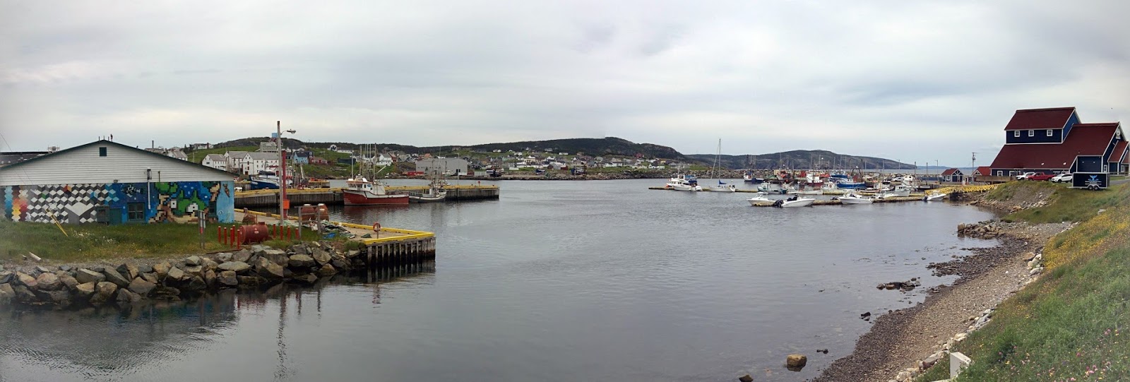
We arrived in Twillingate, the "Iceberg Capital of the World" in time for a late lunch and were rewarded with the best food in all of Newfoundland at the Canvas Cove restaurant. It was also the office for Iceberg Quest ocean tours and we managed to nab the last two seats on a zodiac that would take us out to see the only remaining icebergs in "Iceberg Alley" this season.


It took 2 - 3 years for these icebergs to make their way over from Greenland and it's hard to believe these beautiful chunks of ice are actually 15,000 years old. It's even harder to believe that 90% of these icebergs are still under water. Having the opportunity to get up close to them was awe inspiring, not to mention refreshing and, by the time we got back, we needed some of the famous Newfoundland screech to warm ourselves up a bit.


Historically, Twillingate was another important fishing village but it has since evolved into a popular tourist destination. In addition to going out on the water there is plenty to explore on land, with accessible trails everywhere, particularly around the Long Point Lighthouse at the end of town.


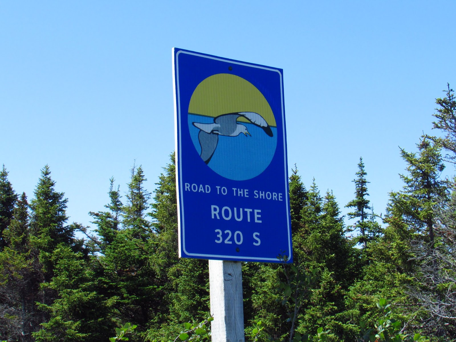
We could have stayed much longer but it was time to head back to St. John's via the Road To The Shore highway that offered both white, sandy beaches and rugged, rocky coastline. It also passed through more small towns with their well maintained shoe box style houses, enormous piles of firewood, and occasionally quirky front lawn decorations.


Back in St. John's we celebrated our amazing holiday with one last feast of mussels and lobster and said goodbye to our funky rock n' roll themed hotel The Jag that had provided the ultimate in accommodations. MerryTimes indeed in the Atlantic Provinces.


Absolutely LOVED this post and the knowledge that went with it. Fantastic trip to the Maritimes.
ReplyDelete